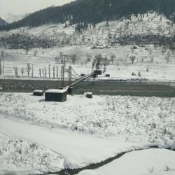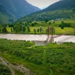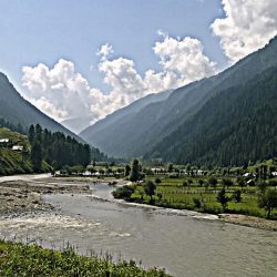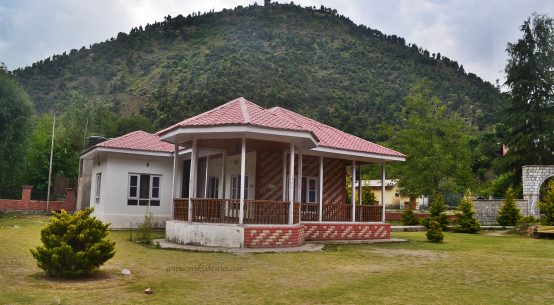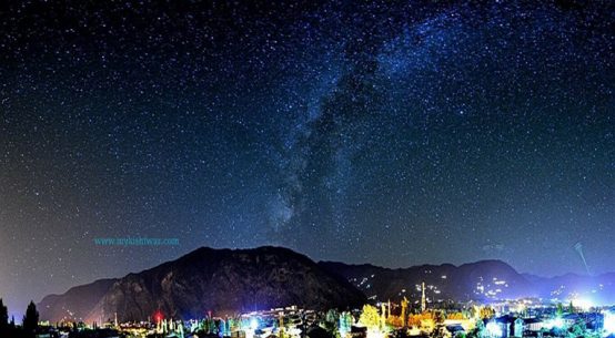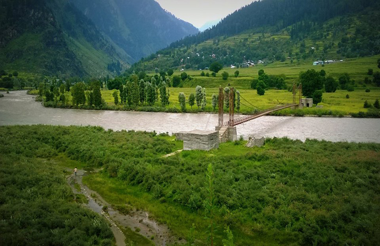
Marwah is a Tehsil in Kishtwar District of Jammu & Kashmir State, India. Marwah Tehsil Head Quarters is Marwah town . It is located 28 KM towards North from District head quarters Kishtwar. 130 KM from State capital Srinagar, Jammu towards west .
Marwah Tehsil is bounded by by Dachhan Tehsil towards South , Kishtwar Tehsil towards South , Gundana Tehsil towards South , Drabshalla Tehsil towards South . Anantnag City , Udhampur City , Chamba City , Srinagar City are the nearby Cities to Marwah.
It is in the 1671 m elevation(altitude) .
Kasmiri is the Local Language here. Also People Speaks Urdu .
Weather and Climate of Marwah Tehsil
It is very cold in summer also. Marwah summer highest day temperature is in between 6 ° C to 27° C .
Average temperatures of January is -1 ° C , February is 1 ° C , March is 6 ° C , April is 9 ° C , May is 13 ° C .
A trek of 25kms ahead of Sirshi along the banks of ‘Mariv Sudir’ up to village ‘Hanzal’, the gate way of Marwah is quite exhilarating and natural beauty is at its peak in this trek. It is populated both by Hindus and Muslims at present. From there the population extends to both sides of the river Marwah upto Yaurdu about one mile or two Kilometers from Nowpachi, the capital of Marwah block and tehsil headquarter. From there one branch goes to Renai where famous hot springs of Marwah are situated. The other branch where from river Marwah traverses is called Warwan valley. Marwah-Warwan has 21 revenue villages namely Yaurdu, Teller, Changer, dehrna, Drarri, Renai, Pathgam, Qaderena, Nowpachi and Nowgam in Marwa and Arwan, Inshan, Afti, Basmana, Mulwarwan, Brayan, Choidraman, Rikanwas, Sukhnai, Margi, Gomri and Monkli in Warwan area. None of these villages have so far been linked by motorable road either from Kishtwar side or Kashmir side. Sukhnai is the last village in warwan area. Marwah has one Higher secondary school and one High school at Dehrna whereas Warwan has only one Higher secondary School. There are a number of middle and primary schools in both these blocks.
Ahead of Hanzal, is the sprawling Marwah valley about 6-8 kms long. Wide comprising villages Teller, Chanjar, Nowpachi, Astaan-gam, Yourdu and Qaderna with ‘Mariv Sudir’ meandering through it. The river of Mariv Sudir provides a lot of irrigative facilities to the farmers in producing maize and local variety of Paddy but the land is not suited for the production of wheat and latest varieties of Paddy and pulses due to its high altitude which is between 6500-7000 feet above sea level. The cold climate of the place hampers agricultural production and as such the area is deficient in food items but its tourism potential is immense. Mariv Sudir provides the facilities of water sports such as water rafting and water skiing.
1. Chanjer – Kishtwar
Chanjer is a large village located in Marwah of Kishtwar district, Jammu and Kashmir with total 487 families residing. The Chanjer village has population of 2174 of which 1108 are males while 1066 are females as per Population Census 2011.
In Chanjer village population of children with age 0-6 is 400 which makes up 18.40 % of total population of village. Average Sex Ratio of Chanjer village is 962 which is higher than Jammu and Kashmir state average of 889. Child Sex Ratio for the Chanjer as per census is 1010, higher than Jammu and Kashmir average of 862.
Chanjer village has lower literacy rate compared to Jammu and Kashmir. In 2011, literacy rate of Chanjer village was 56.37 % compared to 67.16 % of Jammu and Kashmir. In Chanjer Male literacy stands at 70.85 % while female literacy rate was 41.16 %.
As per constitution of India and Panchyati Raaj Act, Chanjer village is administrated by Sarpanch (Head of Village) who is elected representative of village.
Chanjer Data
| Particulars | Total | Male | Female |
|---|---|---|---|
| Total No. of Houses | 487 | – | – |
| Population | 2,174 | 1,108 | 1,066 |
| Child (0-6) | 400 | 199 | 201 |
| Schedule Caste | 0 | 0 | 0 |
| Schedule Tribe | 22 | 9 | 13 |
| Literacy | 56.37 % | 70.85 % | 41.16 % |
| Total Workers | 1,005 | 534 | 471 |
| Main Worker | 487 | 0 | 0 |
| Marginal Worker | 518 | 136 | 382 |
Caste Factor
Work Profile
2. Dharie – Kishtwar
Dharie is a medium size village located in Marwah of Kishtwar district, Jammu and Kashmir with total 78 families residing. The Dharie village has population of 362 of which 172 are males while 190 are females as per Population Census 2011.
In Dharie village population of children with age 0-6 is 60 which makes up 16.57 % of total population of village. Average Sex Ratio of Dharie village is 1105 which is higher than Jammu and Kashmir state average of 889. Child Sex Ratio for the Dharie as per census is 935, higher than Jammu and Kashmir average of 862.
Dharie village has higher literacy rate compared to Jammu and Kashmir. In 2011, literacy rate of Dharie village was 67.88 % compared to 67.16 % of Jammu and Kashmir. In Dharie Male literacy stands at 78.01 % while female literacy rate was 59.01 %.
As per constitution of India and Panchyati Raaj Act, Dharie village is administrated by Sarpanch (Head of Village) who is elected representative of village.
Dharie Data
| Particulars | Total | Male | Female |
|---|---|---|---|
| Total No. of Houses | 78 | – | – |
| Population | 362 | 172 | 190 |
| Child (0-6) | 60 | 31 | 29 |
| Schedule Caste | 0 | 0 | 0 |
| Schedule Tribe | 0 | 0 | 0 |
| Literacy | 67.88 % | 78.01 % | 59.01 % |
| Total Workers | 166 | 73 | 93 |
| Main Worker | 77 | 0 | 0 |
| Marginal Worker | 89 | 7 | 82 |
Caste Factor
Work Profile
3. Deharna – Kishtwar
Deharna is a medium size village located in Marwah of Kishtwar district, Jammu and Kashmir with total 313 families residing. The Deharna village has population of 1424 of which 754 are males while 670 are females as per Population Census 2011.
In Deharna village population of children with age 0-6 is 271 which makes up 19.03 % of total population of village. Average Sex Ratio of Deharna village is 889 which is equal than Jammu and Kashmir state average of 889. Child Sex Ratio for the Deharna as per census is 795, lower than Jammu and Kashmir average of 862.
Deharna village has lower literacy rate compared to Jammu and Kashmir. In 2011, literacy rate of Deharna village was 39.81 % compared to 67.16 % of Jammu and Kashmir. In Deharna Male literacy stands at 55.56 % while female literacy rate was 22.55 %.
As per constitution of India and Panchyati Raaj Act, Deharna village is administrated by Sarpanch (Head of Village) who is elected representative of village.
Deharna Data
| Particulars | Total | Male | Female |
|---|---|---|---|
| Total No. of Houses | 313 | – | – |
| Population | 1,424 | 754 | 670 |
| Child (0-6) | 271 | 151 | 120 |
| Schedule Caste | 0 | 0 | 0 |
| Schedule Tribe | 8 | 6 | 2 |
| Literacy | 39.81 % | 55.56 % | 22.55 % |
| Total Workers | 807 | 419 | 388 |
| Main Worker | 306 | 0 | 0 |
| Marginal Worker | 501 | 161 | 340 |
Caste Factor
Work Profile
4. Nowgam – Kishtwar
Nowgam is a medium size village located in Marwah of Kishtwar district, Jammu and Kashmir with total 80 families residing. The Nowgam village has population of 415 of which 199 are males while 216 are females as per Population Census 2011.
In Nowgam village population of children with age 0-6 is 73 which makes up 17.59 % of total population of village. Average Sex Ratio of Nowgam village is 1085 which is higher than Jammu and Kashmir state average of 889. Child Sex Ratio for the Nowgam as per census is 1028, higher than Jammu and Kashmir average of 862.
Nowgam village has lower literacy rate compared to Jammu and Kashmir. In 2011, literacy rate of Nowgam village was 66.37 % compared to 67.16 % of Jammu and Kashmir. In Nowgam Male literacy stands at 83.44 % while female literacy rate was 50.84 %.
As per constitution of India and Panchyati Raaj Act, Nowgam village is administrated by Sarpanch (Head of Village) who is elected representative of village.
Nowgam Data
| Particulars | Total | Male | Female |
|---|---|---|---|
| Total No. of Houses | 80 | – | – |
| Population | 415 | 199 | 216 |
| Child (0-6) | 73 | 36 | 37 |
| Schedule Caste | 0 | 0 | 0 |
| Schedule Tribe | 0 | 0 | 0 |
| Literacy | 66.37 % | 83.44 % | 50.84 % |
| Total Workers | 205 | 104 | 101 |
| Main Worker | 107 | 0 | 0 |
| Marginal Worker | 98 | 5 | 93 |
Caste Factor
Work Profile
5. Pathgam – Kishtwar
Pathgam is a medium size village located in Marwah of Kishtwar district, Jammu and Kashmir with total 237 families residing. The Pathgam village has population of 1242 of which 644 are males while 598 are females as per Population Census 2011.
In Pathgam village population of children with age 0-6 is 319 which makes up 25.68 % of total population of village. Average Sex Ratio of Pathgam village is 929 which is higher than Jammu and Kashmir state average of 889. Child Sex Ratio for the Pathgam as per census is 945, higher than Jammu and Kashmir average of 862.
Pathgam village has lower literacy rate compared to Jammu and Kashmir. In 2011, literacy rate of Pathgam village was 47.24 % compared to 67.16 % of Jammu and Kashmir. In Pathgam Male literacy stands at 61.25 % while female literacy rate was 32.05 %.
As per constitution of India and Panchyati Raaj Act, Pathgam village is administrated by Sarpanch (Head of Village) who is elected representative of village.
Pathgam Data
| Particulars | Total | Male | Female |
|---|---|---|---|
| Total No. of Houses | 237 | – | – |
| Population | 1,242 | 644 | 598 |
| Child (0-6) | 319 | 164 | 155 |
| Schedule Caste | 0 | 0 | 0 |
| Schedule Tribe | 1 | 0 | 1 |
| Literacy | 47.24 % | 61.25 % | 32.05 % |
| Total Workers | 574 | 288 | 286 |
| Main Worker | 121 | 0 | 0 |
| Marginal Worker | 453 | 174 | 279 |
Caste Factor
Work Profile
6. Nopachi – Kishtwar
Nopachi is a large village located in Marwah of Kishtwar district, Jammu and Kashmir with total 454 families residing. The Nopachi village has population of 2102 of which 1091 are males while 1011 are females as per Population Census 2011.
In Nopachi village population of children with age 0-6 is 362 which makes up 17.22 % of total population of village. Average Sex Ratio of Nopachi village is 927 which is higher than Jammu and Kashmir state average of 889. Child Sex Ratio for the Nopachi as per census is 905, higher than Jammu and Kashmir average of 862.
Nopachi village has lower literacy rate compared to Jammu and Kashmir. In 2011, literacy rate of Nopachi village was 60.17 % compared to 67.16 % of Jammu and Kashmir. In Nopachi Male literacy stands at 74.03 % while female literacy rate was 45.29 %.
As per constitution of India and Panchyati Raaj Act, Nopachi village is administrated by Sarpanch (Head of Village) who is elected representative of village.
Nopachi Data
| Particulars | Total | Male | Female |
|---|---|---|---|
| Total No. of Houses | 454 | – | – |
| Population | 2,102 | 1,091 | 1,011 |
| Child (0-6) | 362 | 190 | 172 |
| Schedule Caste | 0 | 0 | 0 |
| Schedule Tribe | 27 | 13 | 14 |
| Literacy | 60.17 % | 74.03 % | 45.29 % |
| Total Workers | 1,073 | 546 | 527 |
| Main Worker | 406 | 0 | 0 |
| Marginal Worker | 667 | 185 | 482 |
Caste Factor
Work Profile
7. Rinaie – Kishtwar
Rinaie is a medium size village located in Marwah of Kishtwar district, Jammu and Kashmir with total 379 families residing. The Rinaie village has population of 1650 of which 845 are males while 805 are females as per Population Census 2011.
In Rinaie village population of children with age 0-6 is 402 which makes up 24.36 % of total population of village. Average Sex Ratio of Rinaie village is 953 which is higher than Jammu and Kashmir state average of 889. Child Sex Ratio for the Rinaie as per census is 961, higher than Jammu and Kashmir average of 862.
Rinaie village has lower literacy rate compared to Jammu and Kashmir. In 2011, literacy rate of Rinaie village was 41.51 % compared to 67.16 % of Jammu and Kashmir. In Rinaie Male literacy stands at 48.44 % while female literacy rate was 34.21 %.
As per constitution of India and Panchyati Raaj Act, Rinaie village is administrated by Sarpanch (Head of Village) who is elected representative of village.
Rinaie Data
| Particulars | Total | Male | Female |
|---|---|---|---|
| Total No. of Houses | 379 | – | – |
| Population | 1,650 | 845 | 805 |
| Child (0-6) | 402 | 205 | 197 |
| Schedule Caste | 0 | 0 | 0 |
| Schedule Tribe | 120 | 62 | 58 |
| Literacy | 41.51 % | 48.44 % | 34.21 % |
| Total Workers | 767 | 387 | 380 |
| Main Worker | 399 | 0 | 0 |
| Marginal Worker | 368 | 26 | 342 |
Caste Factor
Work Profile
8. Tiller – Kishtwar
Tiller is a medium size village located in Marwah of Kishtwar district, Jammu and Kashmir with total 190 families residing. The Tiller village has population of 762 of which 391 are males while 371 are females as per Population Census 2011.
In Tiller village population of children with age 0-6 is 156 which makes up 20.47 % of total population of village. Average Sex Ratio of Tiller village is 949 which is higher than Jammu and Kashmir state average of 889. Child Sex Ratio for the Tiller as per census is 773, lower than Jammu and Kashmir average of 862.
Tiller village has lower literacy rate compared to Jammu and Kashmir. In 2011, literacy rate of Tiller village was 61.72 % compared to 67.16 % of Jammu and Kashmir. In Tiller Male literacy stands at 82.18 % while female literacy rate was 41.25 %.
As per constitution of India and Panchyati Raaj Act, Tiller village is administrated by Sarpanch (Head of Village) who is elected representative of village.
Tiller Data
| Particulars | Total | Male | Female |
|---|---|---|---|
| Total No. of Houses | 190 | – | – |
| Population | 762 | 391 | 371 |
| Child (0-6) | 156 | 88 | 68 |
| Schedule Caste | 0 | 0 | 0 |
| Schedule Tribe | 0 | 0 | 0 |
| Literacy | 61.72 % | 82.18 % | 41.25 % |
| Total Workers | 403 | 198 | 205 |
| Main Worker | 208 | 0 | 0 |
| Marginal Worker | 195 | 5 | 190 |
Caste Factor
Work Profile
9. Yeerdu – Kishtwar
Yeerdu is a medium size village located in Marwah of Kishtwar district, Jammu and Kashmir with total 344 families residing. The Yeerdu village has population of 1705 of which 871 are males while 834 are females as per Population Census 2011.
In Yeerdu village population of children with age 0-6 is 270 which makes up 15.84 % of total population of village. Average Sex Ratio of Yeerdu village is 958 which is higher than Jammu and Kashmir state average of 889. Child Sex Ratio for the Yeerdu as per census is 942, higher than Jammu and Kashmir average of 862.
Yeerdu village has lower literacy rate compared to Jammu and Kashmir. In 2011, literacy rate of Yeerdu village was 65.23 % compared to 67.16 % of Jammu and Kashmir. In Yeerdu Male literacy stands at 76.91 % while female literacy rate was 53.06 %.
As per constitution of India and Panchyati Raaj Act, Yeerdu village is administrated by Sarpanch (Head of Village) who is elected representative of village.
Yeerdu Data
| Particulars | Total | Male | Female |
|---|---|---|---|
| Total No. of Houses | 344 | – | – |
| Population | 1,705 | 871 | 834 |
| Child (0-6) | 270 | 139 | 131 |
| Schedule Caste | 0 | 0 | 0 |
| Schedule Tribe | 57 | 31 | 26 |
| Literacy | 65.23 % | 76.91 % | 53.06 % |
| Total Workers | 845 | 415 | 430 |
| Main Worker | 281 | 0 | 0 |
| Marginal Worker | 564 | 184 | 380 |
Caste Factor
Work Profile
10. Qaderna – Kishtwar
Qaderna is a medium size village located in Marwah of Kishtwar district, Jammu and Kashmir with total 409 families residing. The Qaderna village has population of 1961 of which 1006 are males while 955 are females as per Population Census 2011.
In Qaderna village population of children with age 0-6 is 516 which makes up 26.31 % of total population of village. Average Sex Ratio of Qaderna village is 949 which is higher than Jammu and Kashmir state average of 889. Child Sex Ratio for the Qaderna as per census is 925, higher than Jammu and Kashmir average of 862.
Qaderna village has lower literacy rate compared to Jammu and Kashmir. In 2011, literacy rate of Qaderna village was 47.89 % compared to 67.16 % of Jammu and Kashmir. In Qaderna Male literacy stands at 60.30 % while female literacy rate was 34.94 %.
As per constitution of India and Panchyati Raaj Act, Qaderna village is administrated by Sarpanch (Head of Village) who is elected representative of village.
Qaderna Data
| Particulars | Total | Male | Female |
|---|---|---|---|
| Total No. of Houses | 409 | – | – |
| Population | 1,961 | 1,006 | 955 |
| Child (0-6) | 516 | 268 | 248 |
| Schedule Caste | 0 | 0 | 0 |
| Schedule Tribe | 28 | 14 | 14 |
| Literacy | 47.89 % | 60.30 % | 34.94 % |
| Total Workers | 887 | 438 | 449 |
| Main Worker | 374 | 0 | 0 |
| Marginal Worker | 513 | 89 | 424 |
Caste Factor
Work Profile
11. Hanzal – Kishtwar
Hanzal is a medium size village located in Marwah of Kishtwar district, Jammu and Kashmir with total 116 families residing. The Hanzal village has population of 472 of which 244 are males while 228 are females as per Population Census 2011.
In Hanzal village population of children with age 0-6 is 73 which makes up 15.47 % of total population of village. Average Sex Ratio of Hanzal village is 934 which is higher than Jammu and Kashmir state average of 889. Child Sex Ratio for the Hanzal as per census is 659, lower than Jammu and Kashmir average of 862.
Hanzal village has lower literacy rate compared to Jammu and Kashmir. In 2011, literacy rate of Hanzal village was 50.13 % compared to 67.16 % of Jammu and Kashmir. In Hanzal Male literacy stands at 65.00 % while female literacy rate was 35.18 %.
As per constitution of India and Panchyati Raaj Act, Hanzal village is administrated by Sarpanch (Head of Village) who is elected representative of village.
Hanzal Data
| Particulars | Total | Male | Female |
|---|---|---|---|
| Total No. of Houses | 116 | – | – |
| Population | 472 | 244 | 228 |
| Child (0-6) | 73 | 44 | 29 |
| Schedule Caste | 0 | 0 | 0 |
| Schedule Tribe | 0 | 0 | 0 |
| Literacy | 50.13 % | 65.00 % | 35.18 % |
| Total Workers | 370 | 189 | 181 |
| Main Worker | 58 | 0 | 0 |
| Marginal Worker | 312 | 140 | 172 |
Caste Factor
Work Profile
