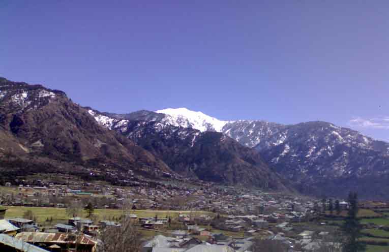
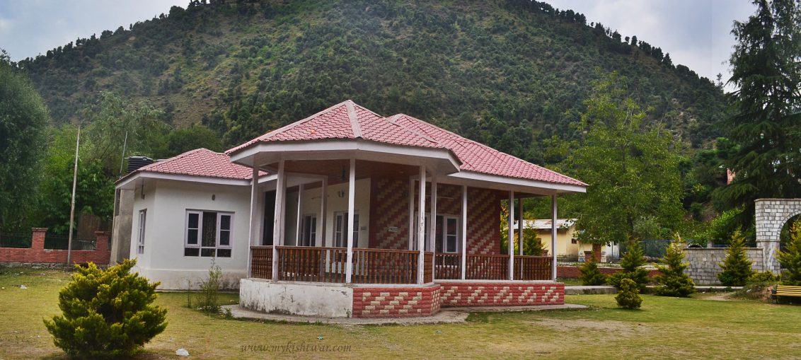
Tehsil Guide · Census Data · Villages · Kishtwar, J&K Tehsil Kishtwar — The Heart of the Saffron Land Geography · Administration · Economy · Census · Villages While Kishtwar is known broadly as a vast, mountainous district in Jammu & Kashmir, Tehsil Kishtwar forms its core administrative, economic, and cultural heartbeat —
Tehsils
Tehsil Drabshalla – Gateway to Southern Kishtwar & India’s Emerging Hydro Power Hub
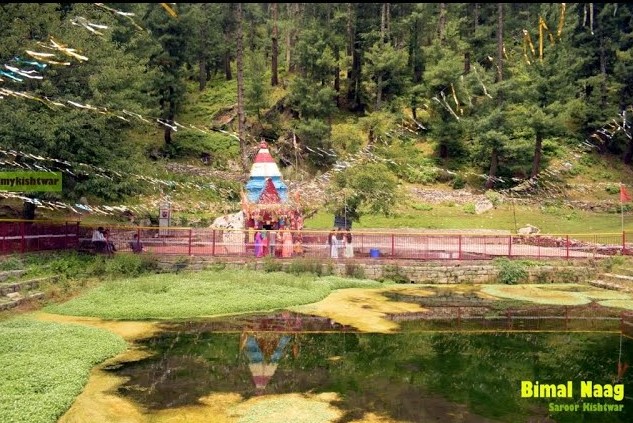
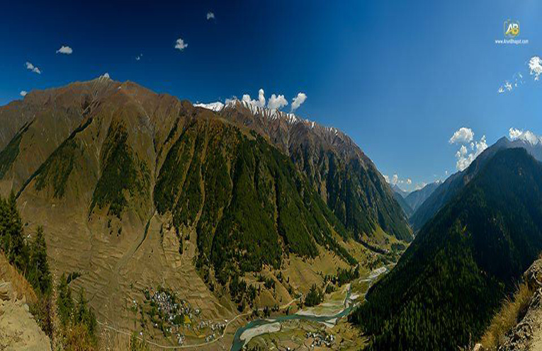
mykishtwar.com · District Guide Series Tehsil Drabshalla Gateway to Southern Kishtwar & India's Emerging Hydro Power Hub ⚡ 850 MW Ratle HEP | 🛣 NH 244 Corridor | 🌿 Banger Valley & Bimal Nag 24,915 Population (2011) 4,782 Households 32 Villages ~17–22 km From Kishtwar 850 MW Ratle HEP 1,600 m Avg. Elevation "Drabshalla sits strategically along the path carved by the roaring Chenab River —
Tehsil Machail
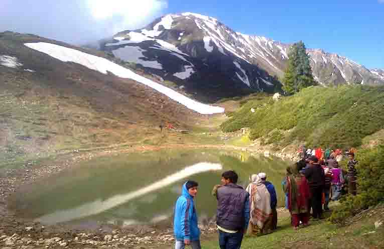
mykishtwar.com · District Guide Series Tehsil Machail Sacred Abode of Chandi Mata · Paddar Sub-Division, Kishtwar ☂ 2nd Biggest Pilgrimage in Jammu Division | 2+ Lakh Yatris Annually Home › Tehsils of Kishtwar › Tehsil Machail 2,800 m Shrine Altitude 2+ Lakh Annual Pilgrims 32 km from Gulabgarh ~290 km From Jammu 5 Villages Revenue Villages 43 Days Annual Yatra Duration "In a remote valley deep within the Paddar
Tehsil Bonjwah
mykishtwar.com · District Guide Series Tehsil Bonjwah (Bunjwah) Home of Devigol — The Mini-Switzerland of Kishtwar 🏔️ Devigol Hill Station | 🌳 Lanka Top Trek | 🌊 Kalnai River Valley 15,899 Population (2011) 2,798 Households ~60 km From Kishtwar ~220 km From Jammu 3,500–9,500 ft Elevation Range 10,000+ Devigol Festival Visitors "Devigol is where Kishtwar reveals its most verdant, most intimate mountain personality — expansive meadows
Tehsil Mughal Maidan
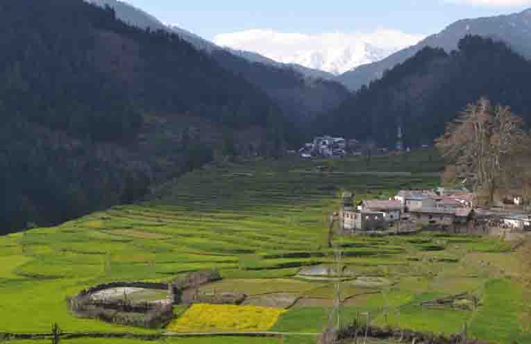
mykishtwar.com · District Guide Series Tehsil Mughal Maidan The Green Gateway to the Scenic Highlands of Chatroo Sub-Division 🏔️ Singhpora Pass Trek | 🍽️ Chatroo River Trout | 🍎 Finest Walnut Country Home › Tehsils of Kishtwar › Tehsil Mughal Maidan 25,827 Population (2011) 5,773 Households 1,500 m Elevation ~22 km From Kishtwar 15 Panchayats Administrative Units 3,527 m Singhpora Pass "Eight kilometres ahead of Bhandaroot comes Mughal Maidan
Tehsil Warwan
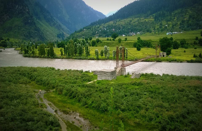
mykishtwar.com · District Guide Series Tehsil Warwan The Hidden Himalayan Paradise of Kishtwar District 🏔️ Margan Top 4,470 m | 🏔️ Nun Kun 7,135 m & 7,877 m | 🌿 Warwan River Valley Home › Tehsils of Kishtwar › Tehsil Warwan 2,100–2,200 m Valley Elevation 4,470 m Margan Top Pass 7 Entry Points To Warwan Valley 68 km From Kishtwar HQ 89 km From Srinagar (via
Tehsil Marwah
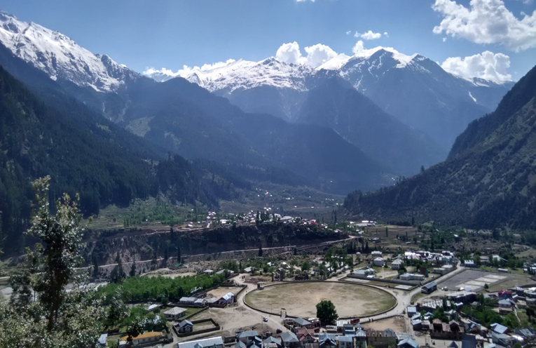
District Kishtwar · Jammu & Kashmir Tehsil Marwah The Untouched Himalayan Paradise of the Chenab Valley 🏔️ Inner Himalayas | 🌿 Marusudar River Valley | ♨️ Tatapani Hot Springs ~40,000 Population 21 Revenue Villages 307 km² Area 2,000–2,200 m Valley Floor Elevation 3,670 m Margan Top Pass 100 km Marwah–Anantnag Road "Tucked deep inside the rugged embrace of the Great Himalayas, Tehsil Marwah is a place
Tehsil Chattroo
District Kishtwar · Jammu & Kashmir Tehsil Chattroo The Hidden Himalayan Paradise of Chenab Valley 📍 30 km from Kishtwar Town | 🏔️ Gateway to Sinthan Top | 🍽️ Famous for Trout Fishing 44,087 Population 11 Revenue Villages 3,784 m Sinthan Top ~30 km From Kishtwar ~202 km Kishtwar to Srinagar "Far from the noise of urban life, tucked between high-rising mountains, dense forests,
Tehsil Nagseni
mykishtwar.com · District Guide Series Tehsil Nagseni Land of Forests, Sacred Springs & Ancient Buddhist Heritage 🌿 Dense Himalayan Forests | ☀️ Gumai Nag Sacred Spring | 🏔️ Rakas Kund Lake Home › Tehsils of Kishtwar › Tehsil Nagseni ~30 km From Kishtwar Town 697 km² Area 11+ Villages 2nd c. BCE Nagasena Connection Kishtwar–Paddar Road Corridor North-East Direction from Kishtwar "Nagseni — full of scenic beauty and located
Tehsil Dachhan
mykishtwar.com · District Guide Series Tehsil Dachhan The Untouched Jewel of Kishtwar— A World Apart 🏔️ Sickle Moon 6,774 m | 🏭 Kishtwar National Park | 🌿 Gucchi Mushrooms Home › Tehsils of Kishtwar › Tehsil Dachhan 12,765 Population 100.50 km² Area 6,774 m Sickle Moon Peak ~50 km From Kishtwar Town (on foot) 9 Panchayat Halqas 3 Nalas Kiyar · Kibber · Nanth "Lofty hills stand guard over
Tehsil Atholi (Paddar)
District Kishtwar · Jammu & Kashmir Tehsil Atholi (Paddar) The Majestic Sapphire Valley of the Great Himalayas 📍 42 km East of Kishtwar Town | 🏔️ 1,938 m Above Sea Level | 💎 Land of Holy Nagas 19,734 Population 3,900 Households 27 Revenue Villages 5,340 m Umasi La Pass 2005 Tehsil Status Year "Where the Chenab roars through granite gorges and glaciers feed ancient