Authored by: Bernd Looft
Pics Credit : (Bearnd Looft, Paul Turk, & Jan Vincent Klene)
*This travel story is copyrighted to the author and cannot be produced or used without proper permission.
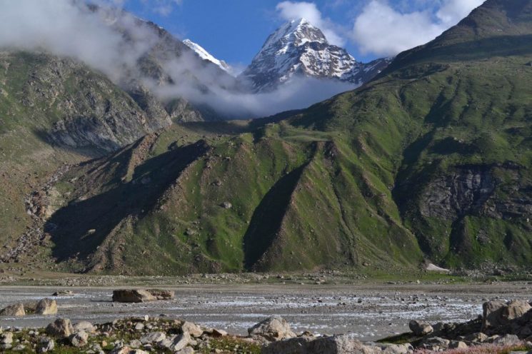
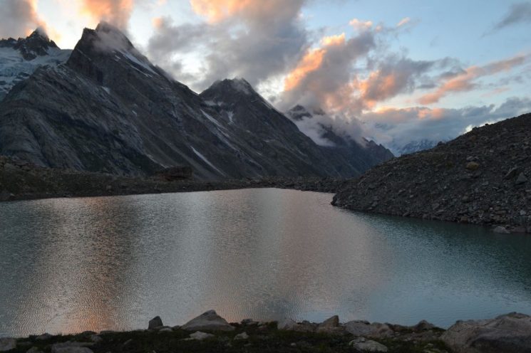
This section was really world class !!! ![]()
![]()
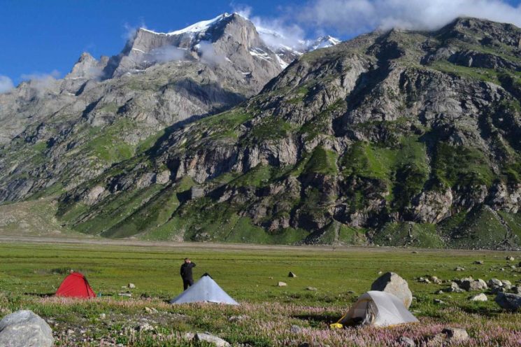
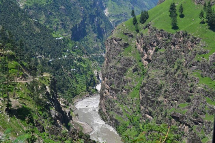
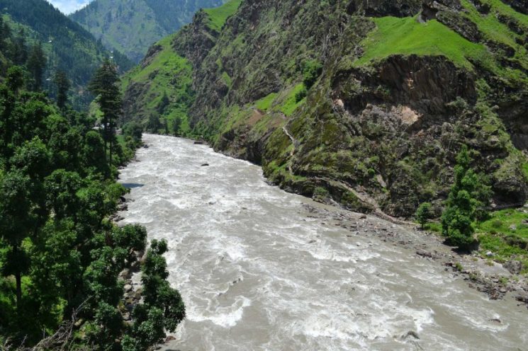
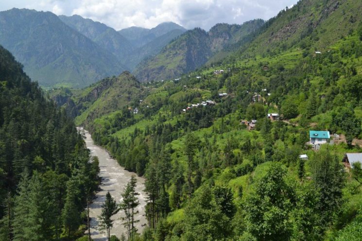
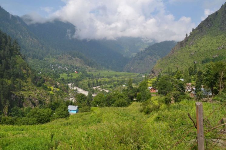
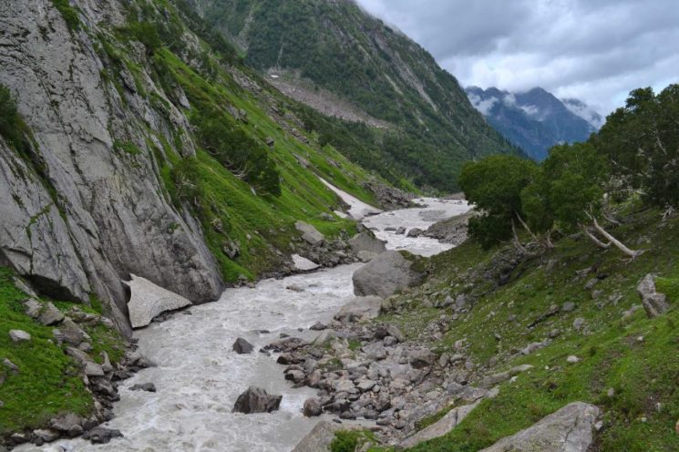
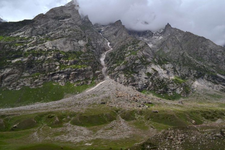
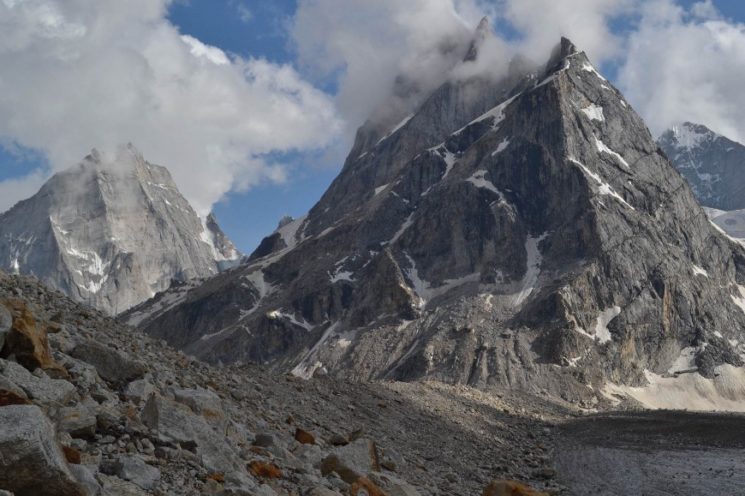
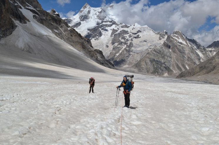
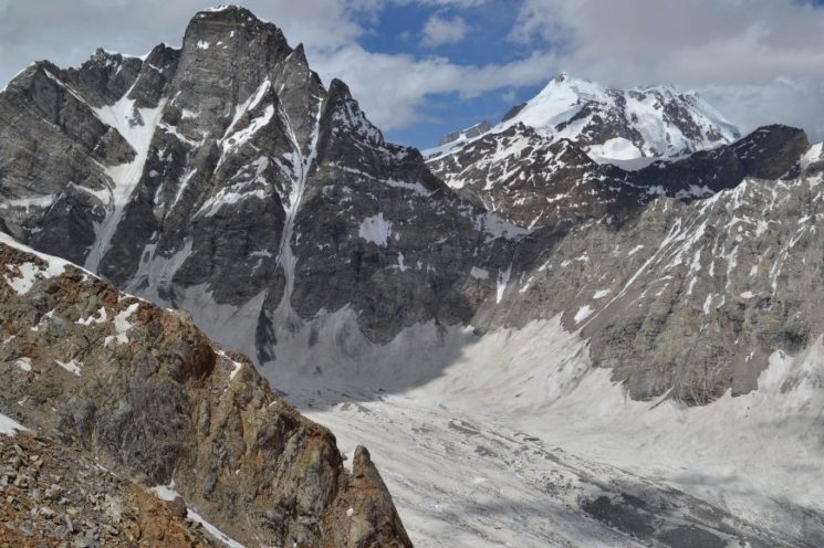
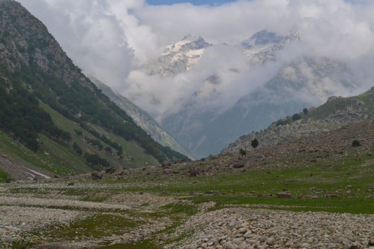
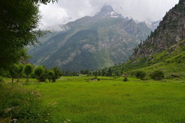
It goes through a magnificent high mountain landscape, a total of almost 350 kilometers, of which 120 kilometers over glaciers, with the crossing of five five-thousand-meter passes and by lonely undeveloped areas.
Our first 10 days take us through the Kishtwar National Park.
Kishtwar National Park – general information
This remote and remote national park is located in the Kishtwar Himalayas in the Indian state of Jammu and Kashmir.
The Kishtwar National Park is even indicated on Google Maps, but if you mention on the spot in Kishtwar that you want to hike through the Kishtwar National Park, you will notice that, with a few exceptions, hardly anyone knows it ![]()
 ,
,
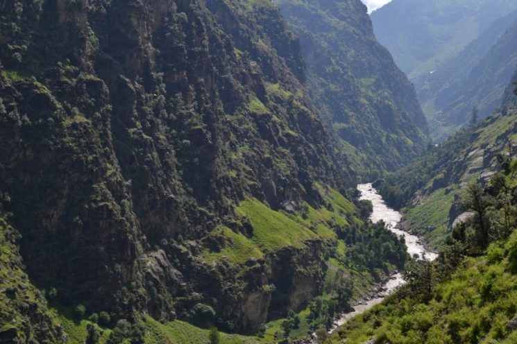
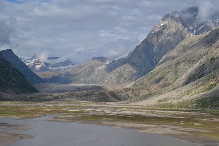
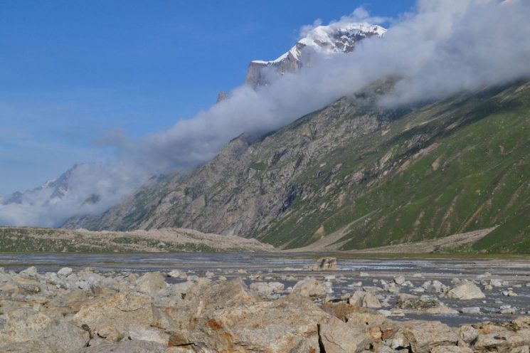
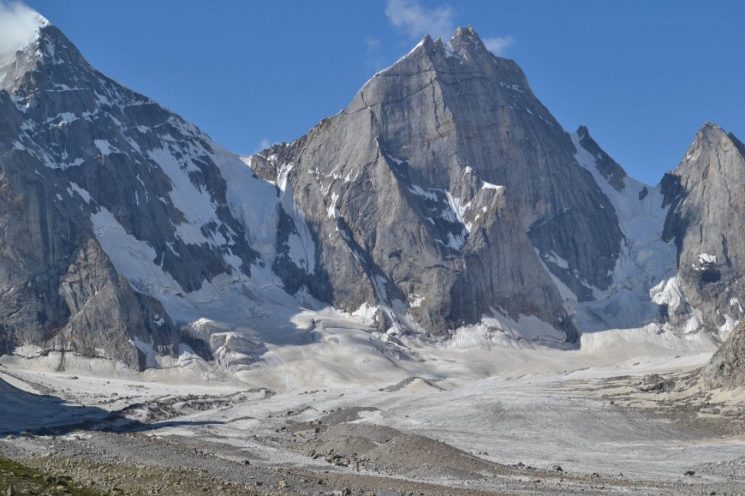
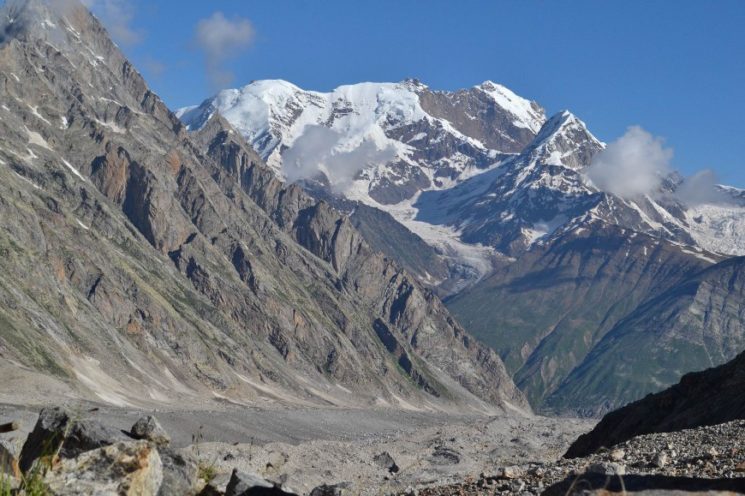
Covering an area of 2100 square kilometers, an undeveloped mountain wilderness is protected on the Himalayan ridge, with deeply cut valleys, surmounted by steep glaciated mountain ranges with spectacularly beautiful peaks such as the Brahma 1 (6416 m), Brahma 2 (6425 m), Kishtwar Kailash ( 6451 m) and Sickle Moon Peak (6574 m).
The Kishtwar National Park is a paradise for extreme climbers who want to climb never climbed or rarely climbed summits. Likewise a paradise for trekkers with alpine experience, because one finds there no easy unggletscherten passes.
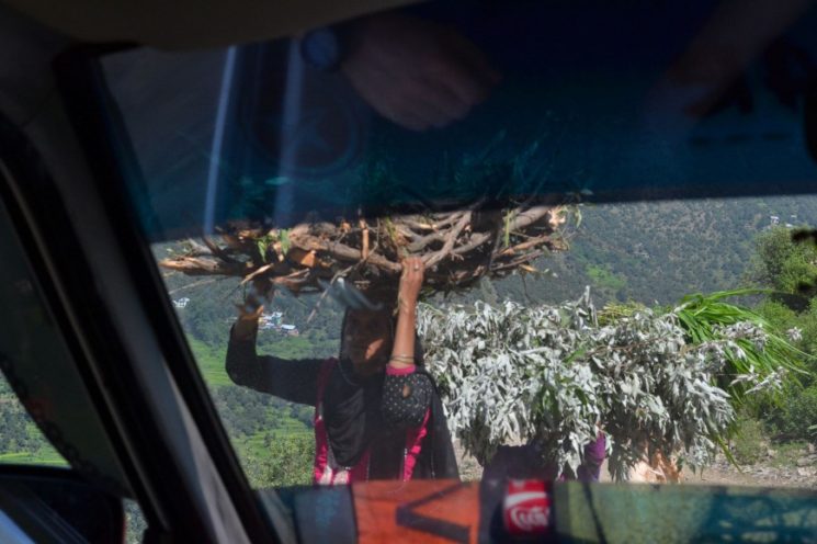
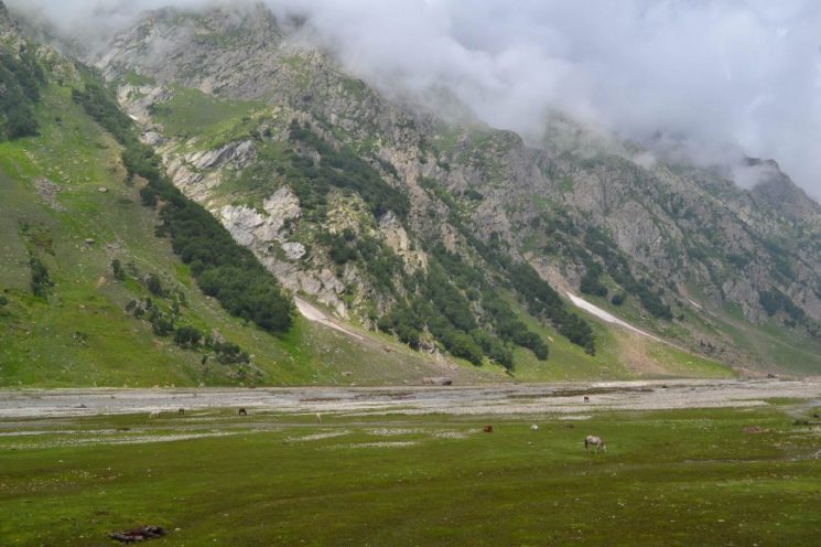
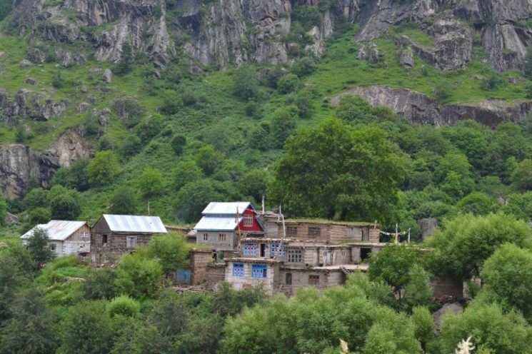
In the lower valleys are some small permanently inhabited villages and in the high valleys above the tree line over 1000 nomadic families grazing rights.
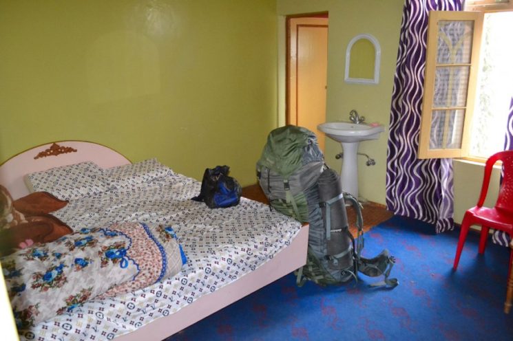
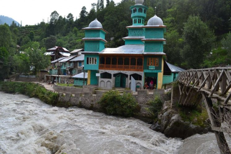
The arrival
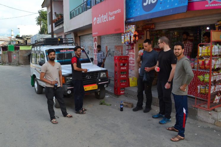
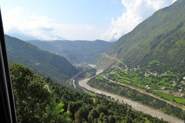
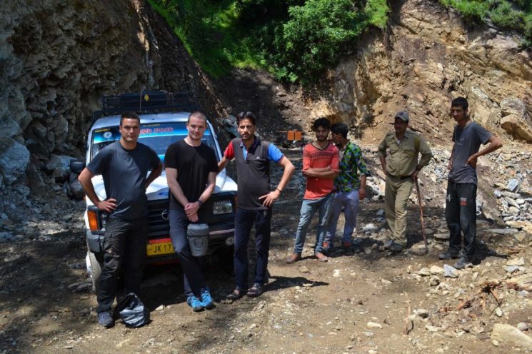
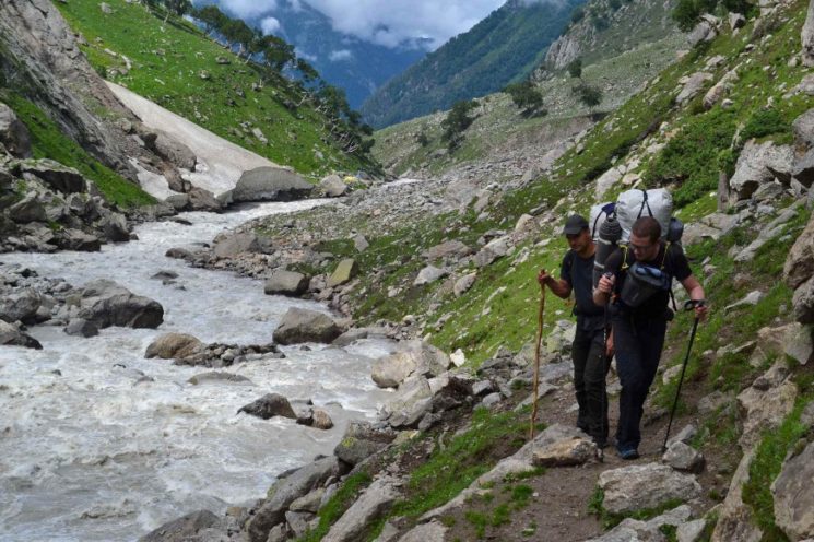
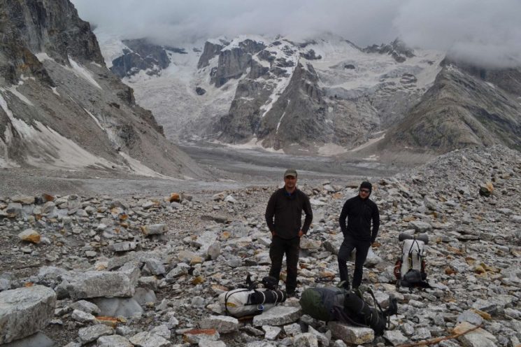
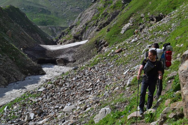
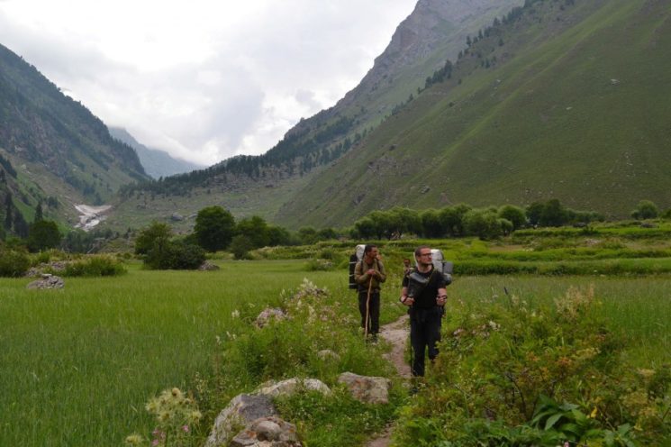
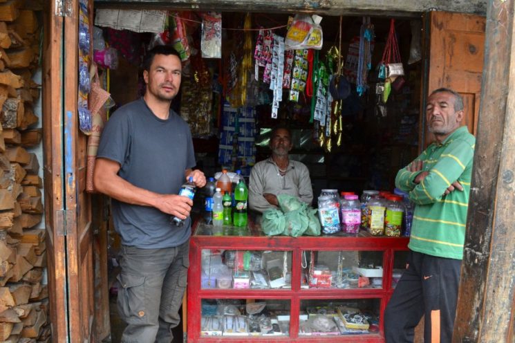
Our trekking start point is in the Marva River Valley, 45 kilometers from Kishtwar. We rent an off-road vehicle with a driver Pardeep has given us. The journey along the narrow bumpy mountain track takes over three hours.

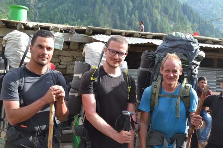
1st and 2nd Day:
Our destination is Padum, the capital of the former Buddhist kingdom Zanskar, which we want to reach in 20 days.
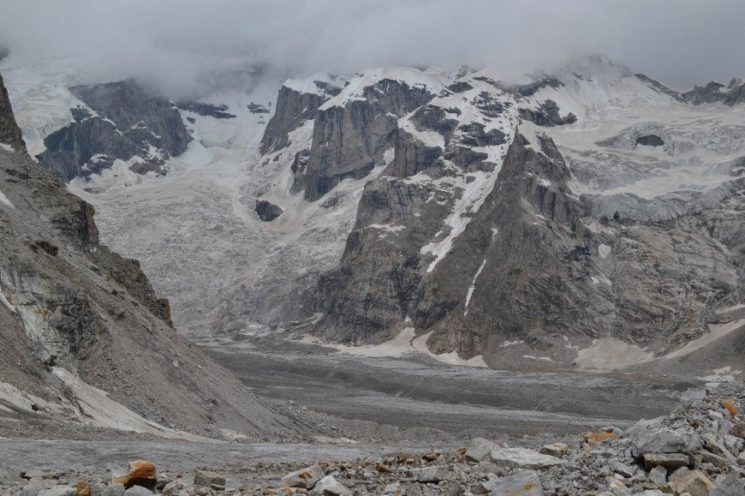
From the end of the track, we first follow the valley for over 90 kilometers through the Kishtwar National Park to the first glaciated 5000-meter pass.
This completely unknown pass was also the first sticking point of this trip, where I was not so sure if he was even crossable before. On Google Earth, it looks steep but doable! But you can not be 100% sure ![]() ,
,
There would not be any real alternative routes here, as it is the only passable looking pass that leads from Kishtwar National Park across the Himalayas to Machail.
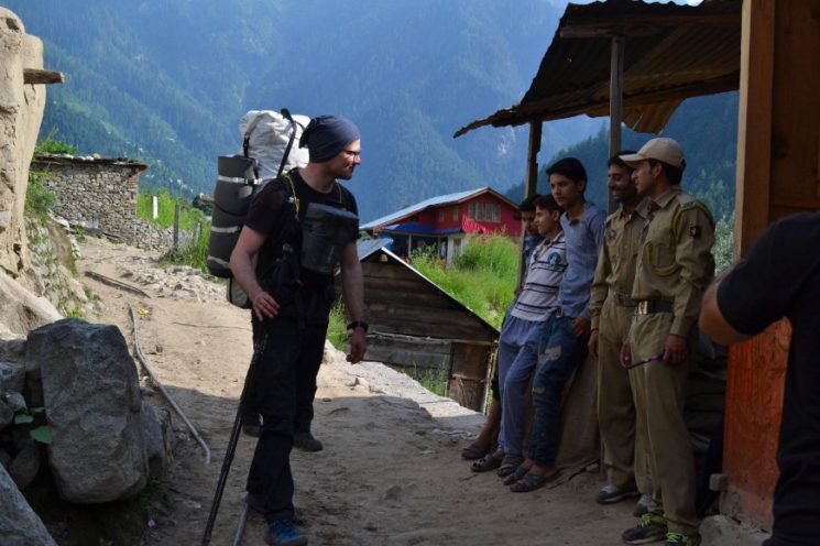
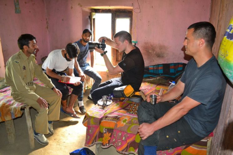
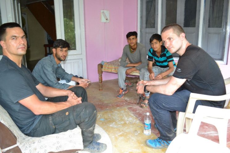
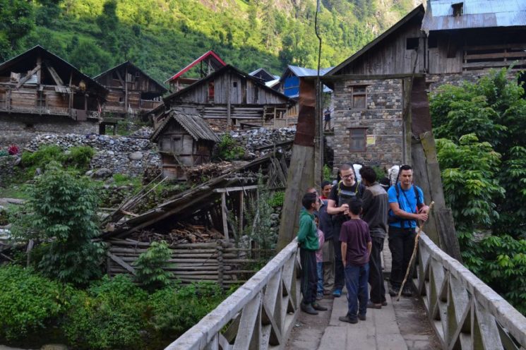
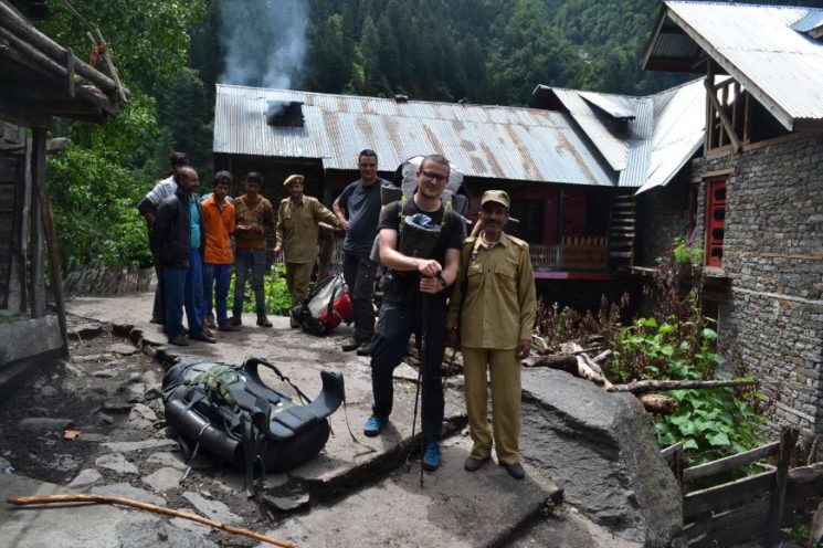
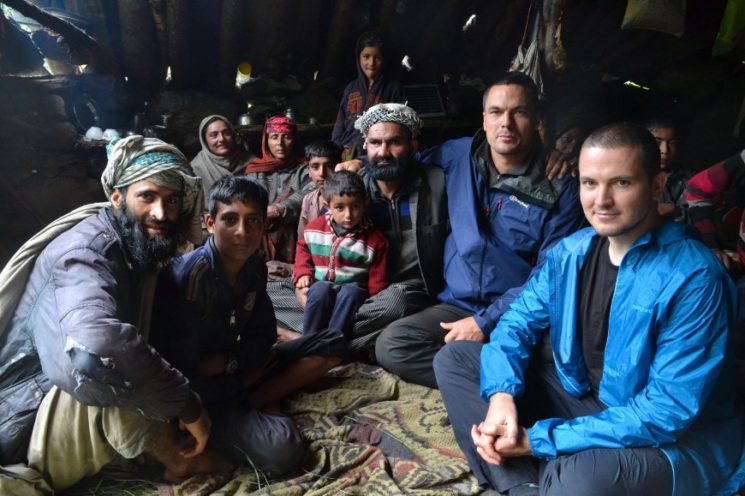
Until the last village, which we reach in the morning of the third day, we pass three police posts and two military posts. At each we are extensively controlled, which always lasts half an hour and each time with the queasy feeling that they will not let us through, because we have no permits. ![]()
![]()
Our non-existent permits did not interest them at all. The reason why they were inclined not to let us through was more because they did not take us for full! They take us for unsuspecting tourists who do not know what they are doing. 
![]()
“Passports please! Where do you want to go? “
“We want to go to the end of the Valley, then cross the mountains and on the other side down to Machail Village”.
“No! You can’t go this way! There is no trail! This route is impossible! “
It has then degenerated into a short discussion each time:
“If this route is impossible, we will come back the same way.”
In the end, they let us through. ![]()
![]()
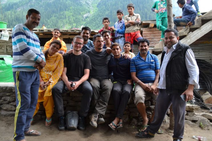
After our passports are checked and all data written down, they are even really friendly. Tea and biscuits are offered and even military escort, but of course we refuse.
From the villagers, nobody seems to know a route over the mountains to Machail.
Only the nomads at the upper end of the valley know that there is a transition. You even know which side glacier you have to climb to get to this transition. One told us that this pass is even crossed once or twice a year by nomads.


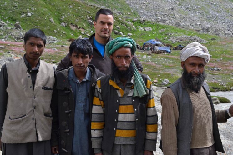
In contrast to my previous trekking section, you usually meet people here in the villages who speak English. When I ask if occasional western trekking tourists come through here, I get the following answer,
“Here are more often times through which the last I saw two years ago”.
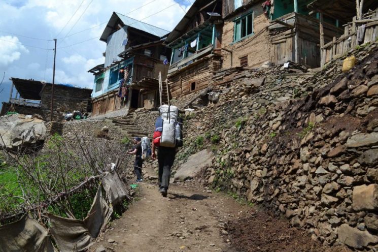
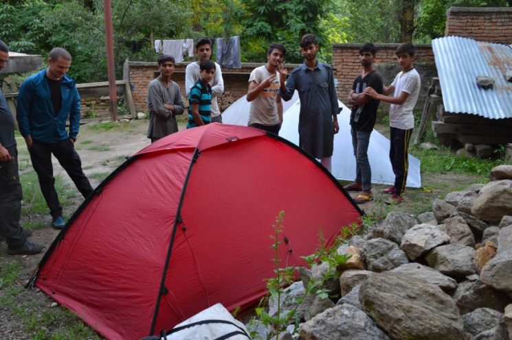
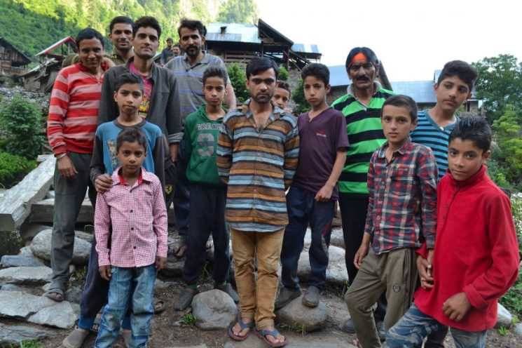
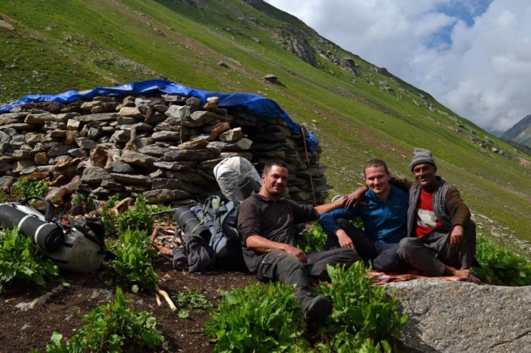
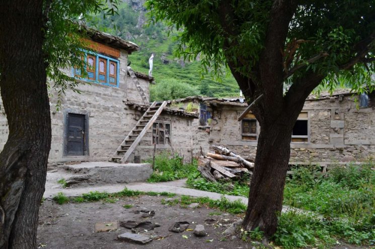
In the evening we reach the village Suid at 1750 m altitude.
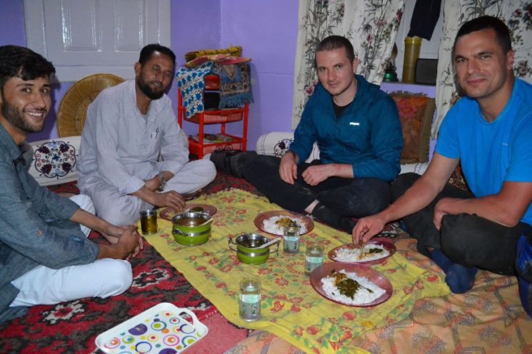
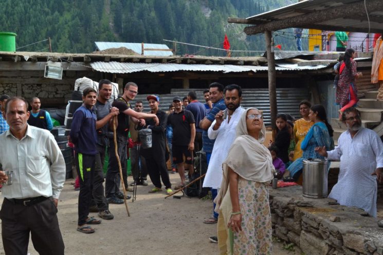
In Suid we are invited by locals to stay overnight. Actually, we wanted to decline the invitation, but finally accept it, on the condition that we are allowed to camp in the garden. Of course we can!
As soon as the tents are open, the persuasive art begins to bring us into the house for the night. But we stay in the tents.
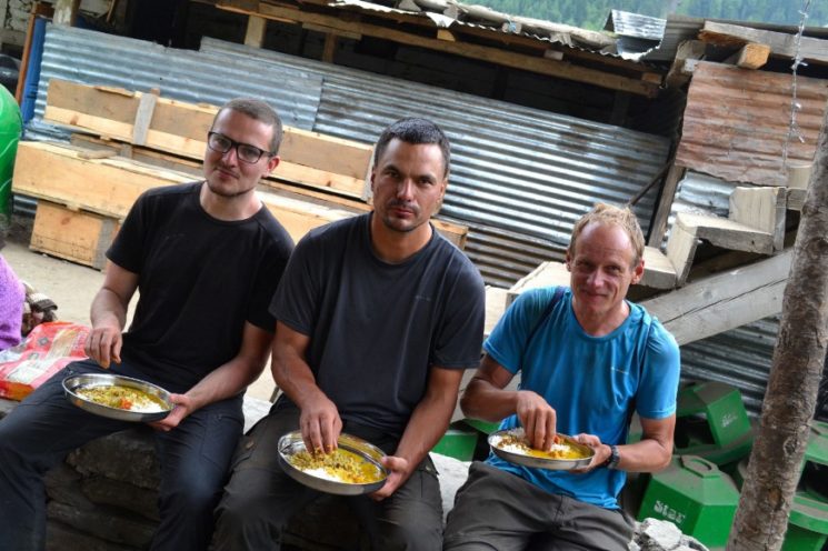
For dinner we are invited to the house.
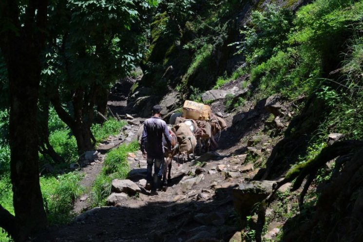
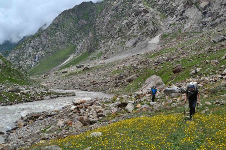
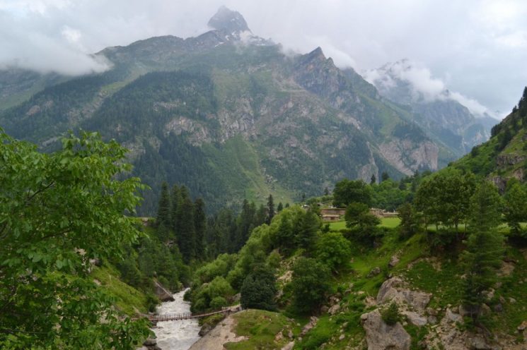
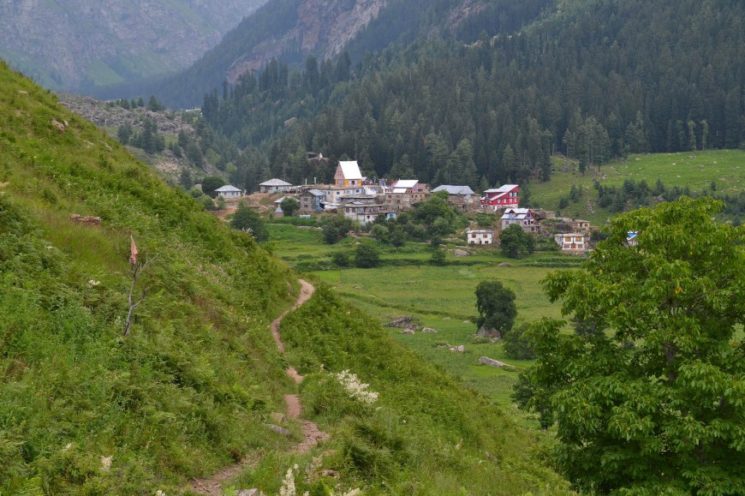
2.Day: at first it rains, but then it clears up slowly. We hike further up the valley through dense population.
there we reach a large fork in the valley. We walk into the right valley (Kiar River Valley).
I would have come out of the left valley if I had followed the Pir Panjal Range in the last trekking section.
Kiar River Valley – at the fork in the valley, the Kishtwar National Park begins, according to Google Maps, and the density of settlements is decreasing significantly. The valley is densely forested with only a few small villages left.
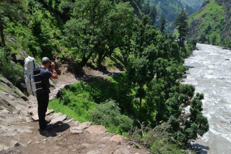
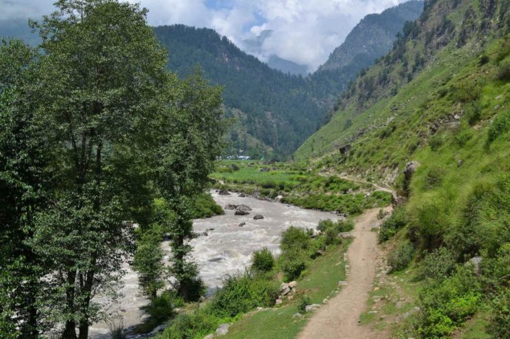
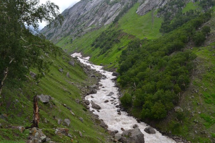
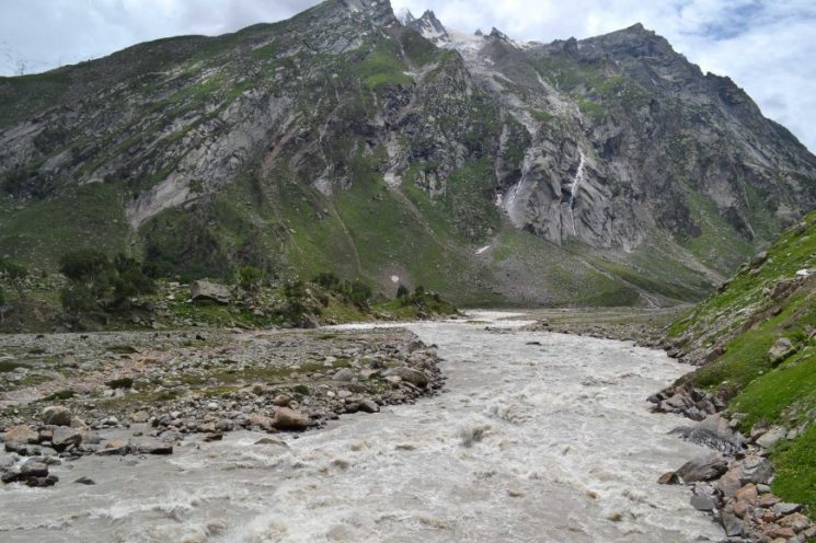
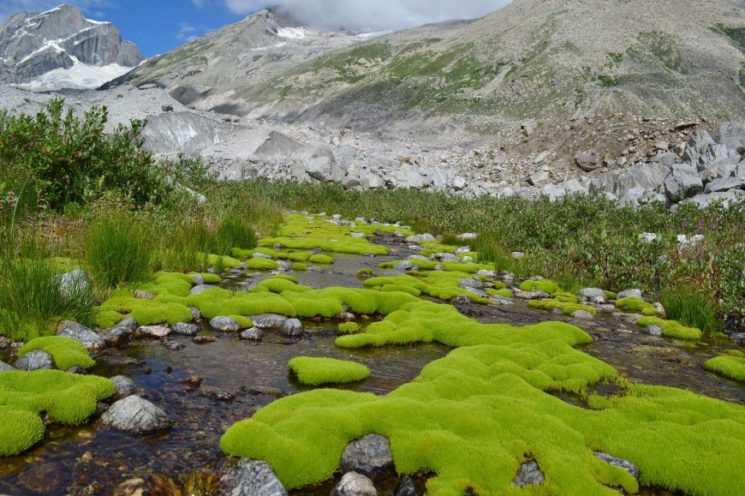
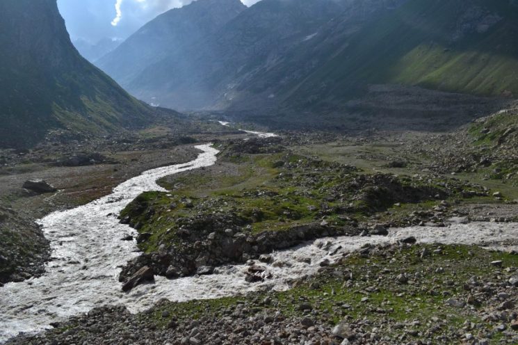
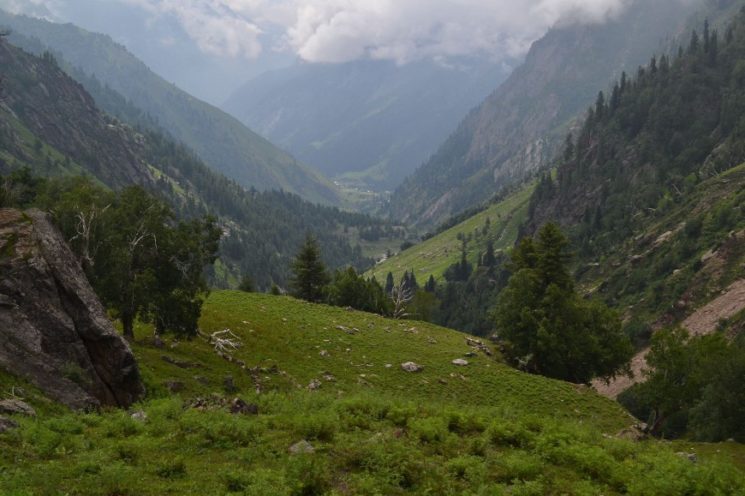
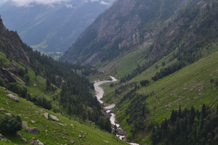
Kiar River Valley – for the next 15 kilometers, the trail runs flat along the river. It is a beautiful valley.
Kiar River Valley – in the background you can see the pass I would have come down if on my last trekking section the bridge in the upper Warwan River Valley had not washed away and I had gone my originally planned route.
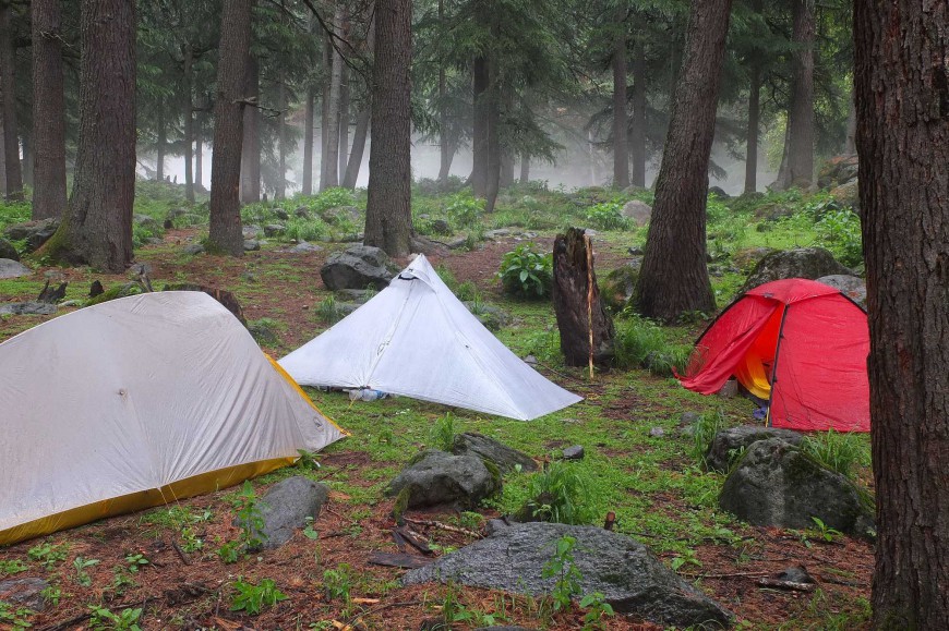
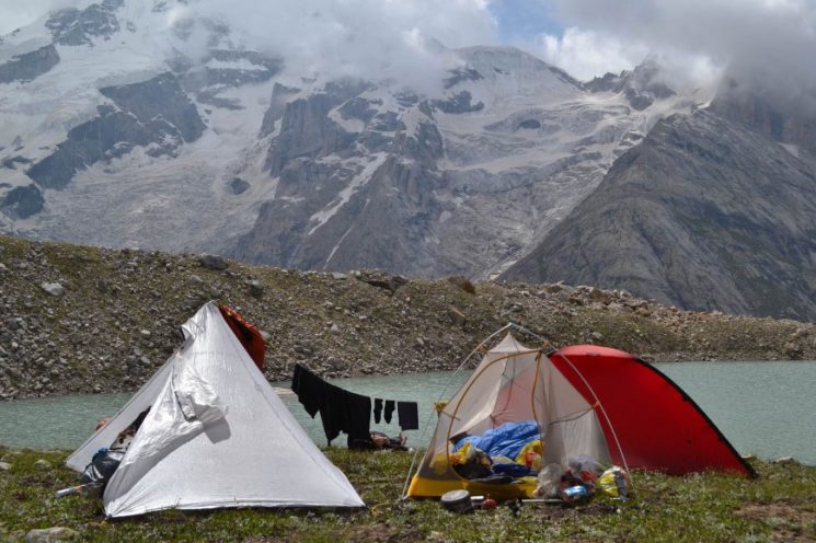
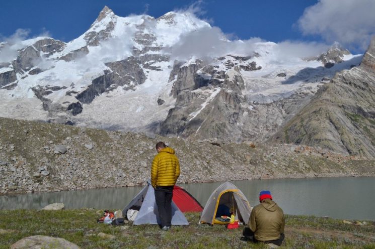
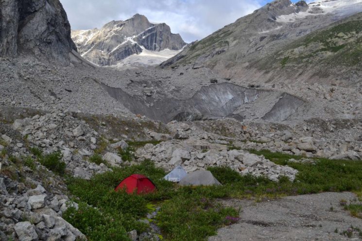
Camp 2 (2180 m), 29.5 km from the trekking start point. An idyllic campsite in the forest between the last and penultimate village.
(Paul’s photo)
Day 3 and 4: Kishtwar National Park
Day 3: As it rains in the morning, we do not start walking until half past eleven, following the path through the forest further up the valley.
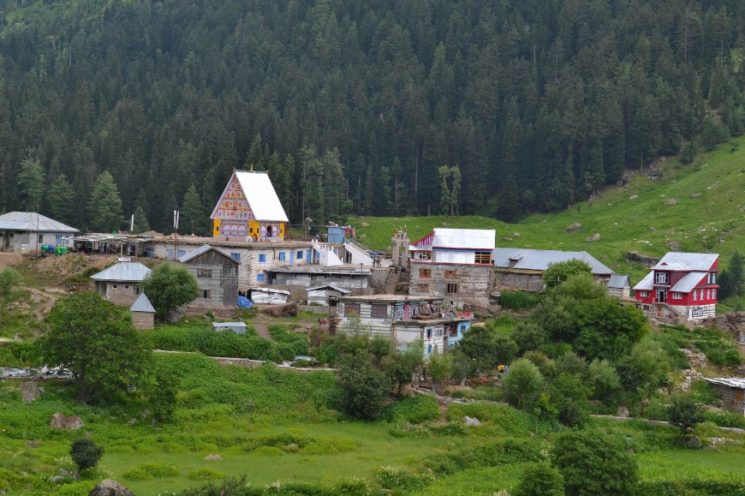
after a kilometer we reach the last village in this valley. Here is the last police station, where we have to register again.
the last village.
(Paul’s photo)
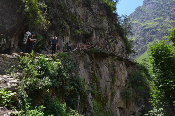
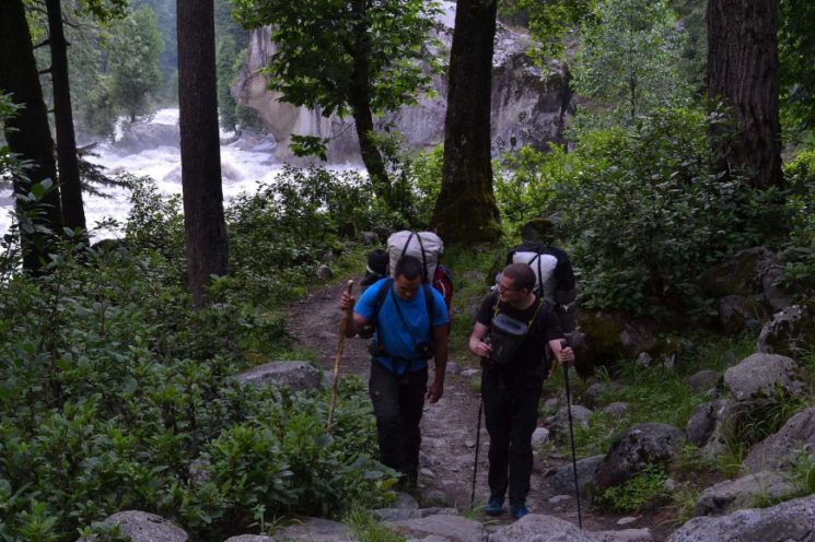
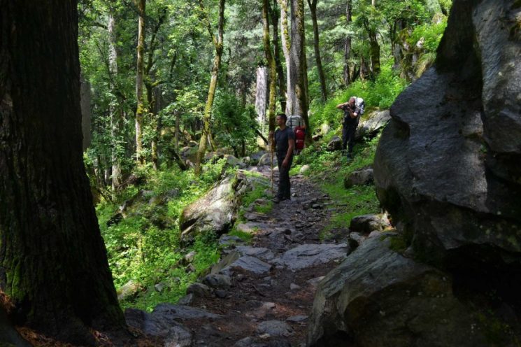
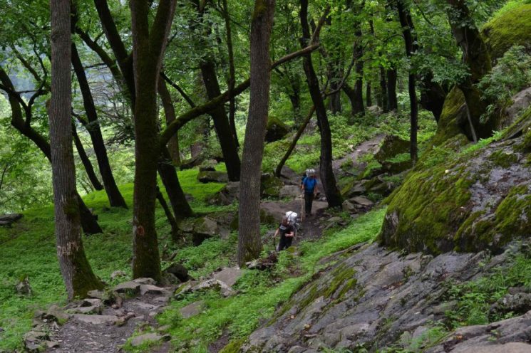
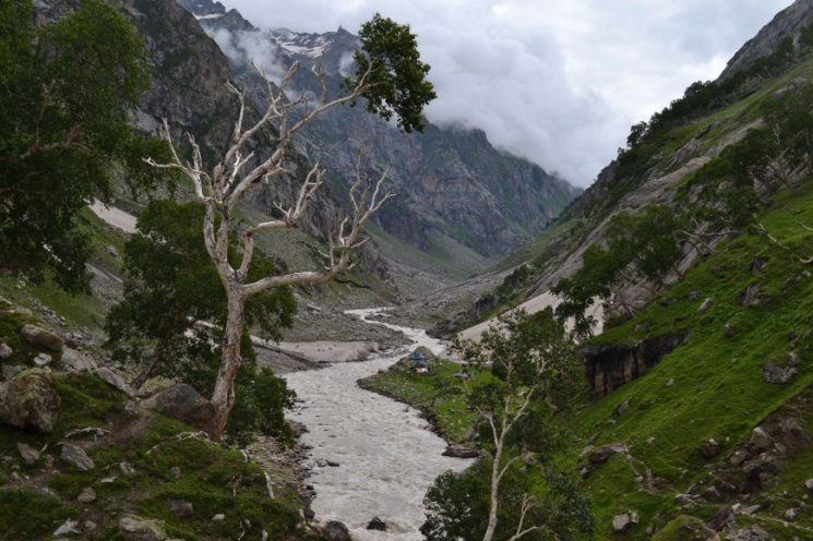
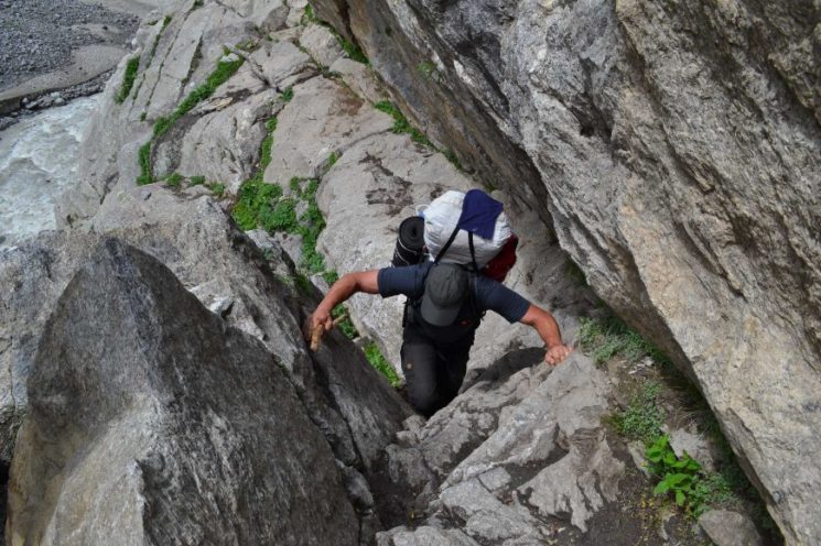
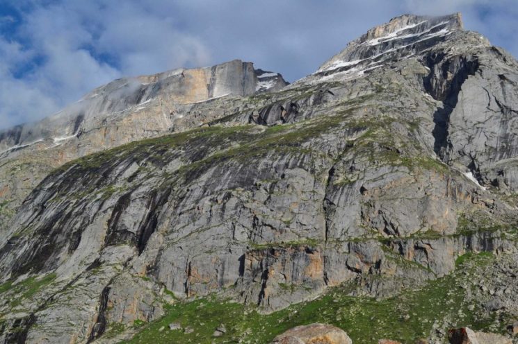
From the village, the path is narrower and much less committed. He constantly walks up and down the slopes. We will not meet people for the next few hours. The valley is really fantastic, very wild, narrow and wooded, the mountains are alpine …… ![]()
![]()
![]()
Kiar River Valley – from the last village the valley becomes much more attractive with beautiful mixed forest
the path leads partly along the steep slopes
From late afternoon the forest slowly starts to clear and the terrain becomes more open.
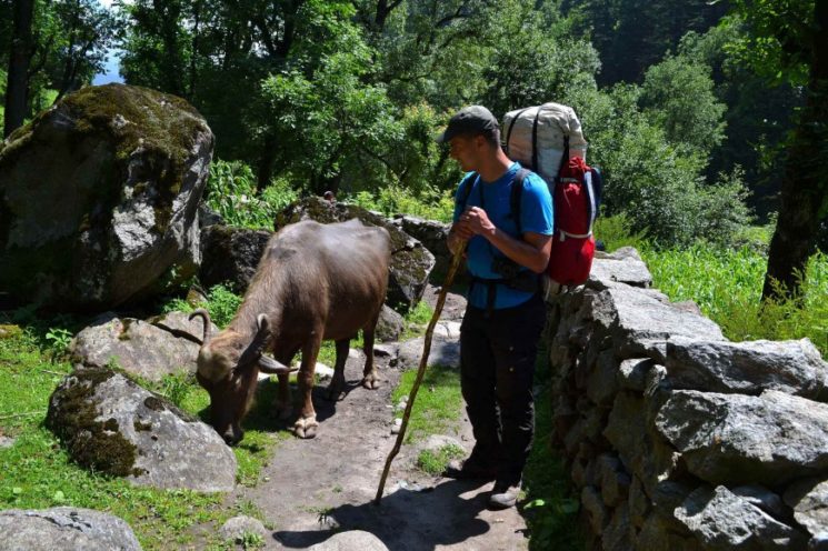
From here we pass the first nomad camps.
Camp 3 (2890 m)
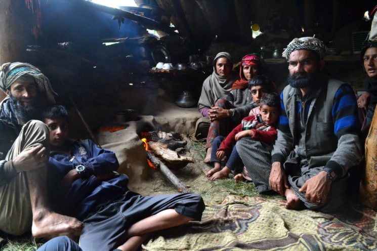
we get visit from nomads

Day 4: Today we did not get far, because it has been raining for most of the day ![]()
When the camp is cleared, a group of nomads comes by and invites us to tea in their hut. There we stay for a while ….
In this small hut they live with the whole family.
uncomfortable day – even the cattle are setting themselves down ![]()
in the rain we continue up the valley
longer rain break under a rock overhang.
We use the short rain-free times to move on.
gorgeous alpine birch forest sections.
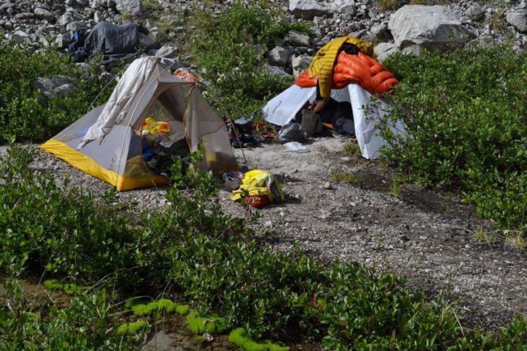
Camp 4 (3280 m), 45 kilometers from the start.
In the pouring rain we set up our tents on the water-soaked ground ![]()
![]()
As the rain finally ceases in the evening, it clears up and the ground is again fairly free of water, we see that this is not such a bad camp site ![]()
![]()
5th and 6th day: Kishtwar National Park

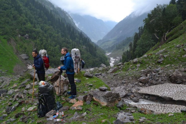
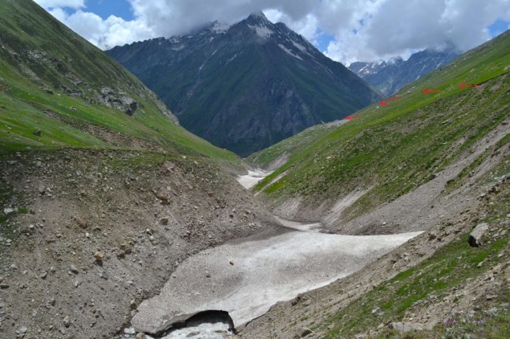
5th day: on the way to the first glaciated pass we continue hiking up the valley.
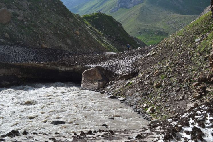
down below you can see two nomad women crossing the river on a snow bridge.
View up the valley
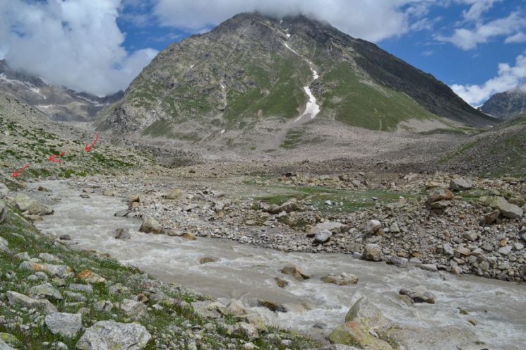
above 3000 m disappear the last forest sections and the valley becomes open-alpine. We pass many nomad camps. One can be seen here on the other side of the river.
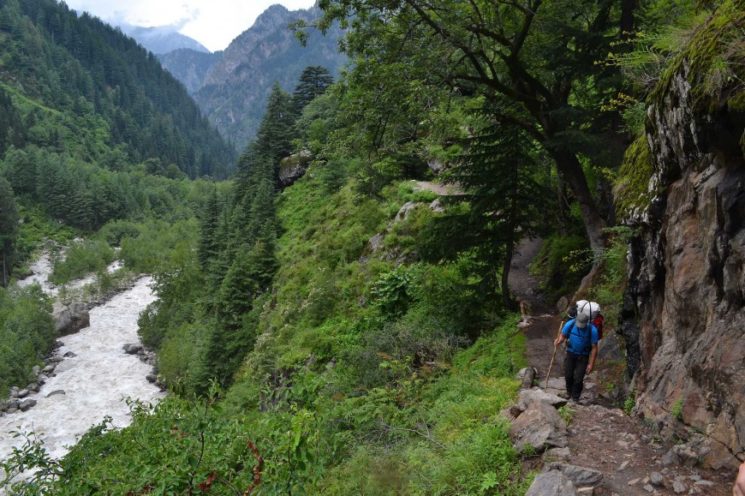
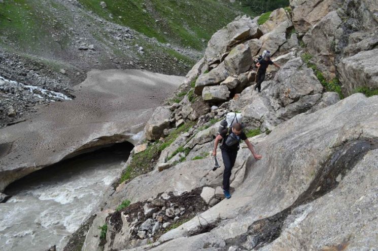
The route is in places adventurous along steep rocky slopes above the river.
View into a side valley
the further up the valley we come, the higher alpine becomes the mountain landscape ![]()
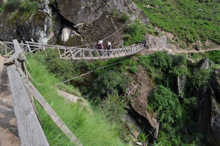
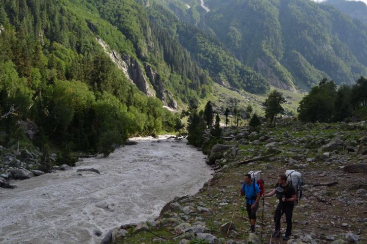
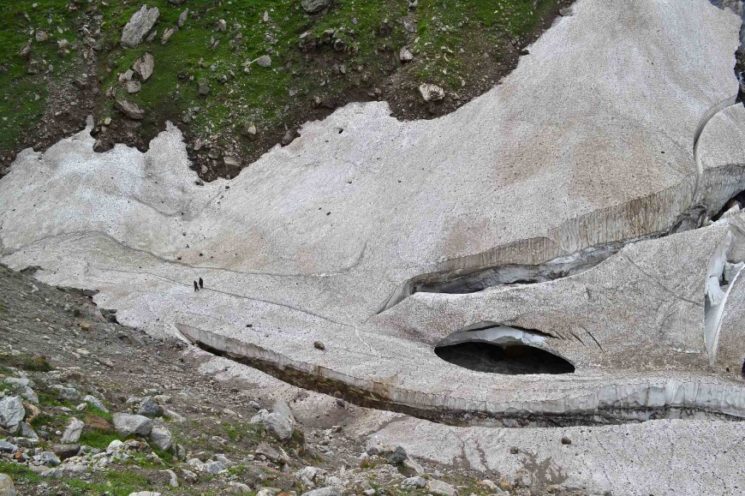
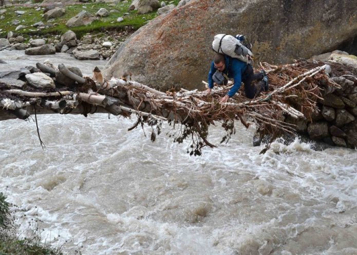
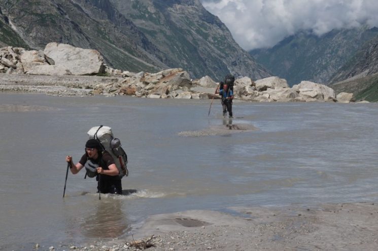
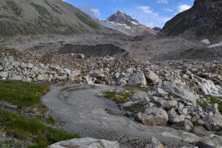
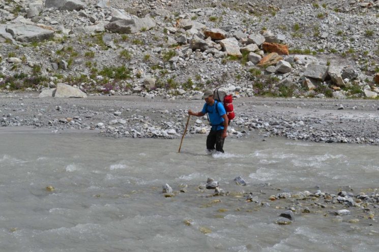
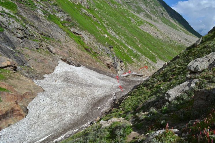
At some point during the day, the river has to be crossed ![]() , There are two options: Either over a hair-raising bridge that was tied together by the nomads from birch branches, or a few miles before via a snow bridge. We decide on the birch tree bridge.
, There are two options: Either over a hair-raising bridge that was tied together by the nomads from birch branches, or a few miles before via a snow bridge. We decide on the birch tree bridge.
river crossing
here again the bridge from afar
typical nomad camp
(Paul’s photo)
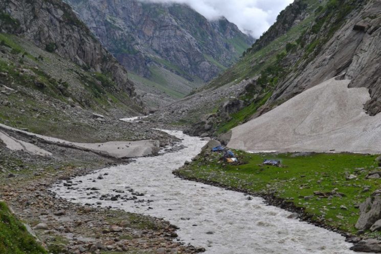
Looking up the valley – on the valley we start our camp
Camp 5 (3650 m)
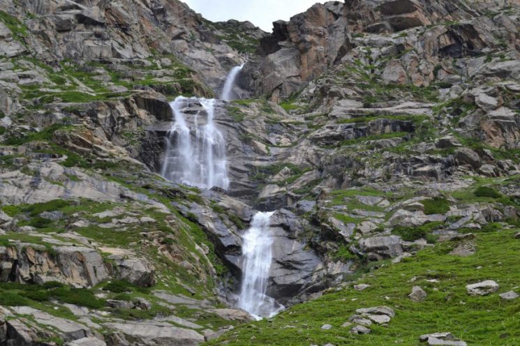
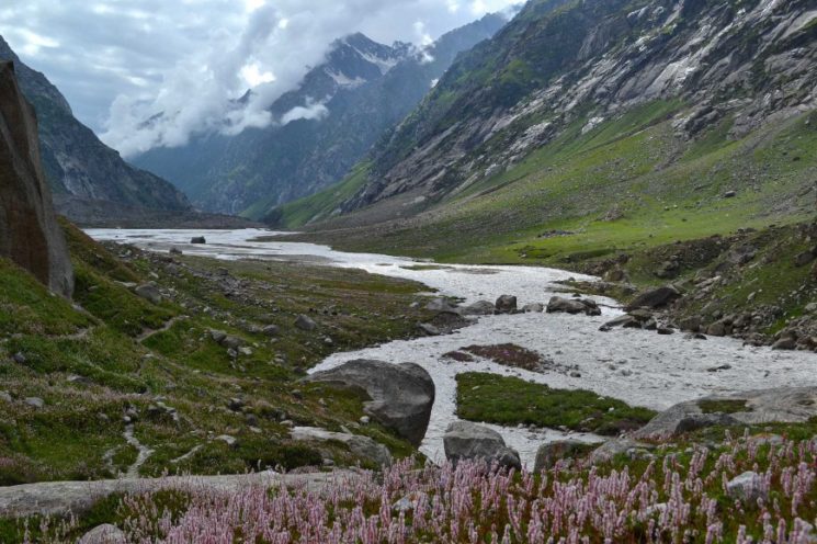
Day 6: View into a spectacular side valley ![]()
![]()
(Paul’s photo)
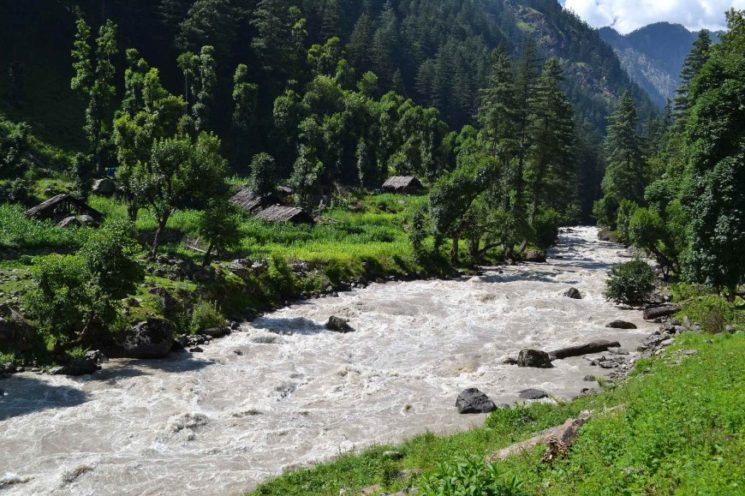
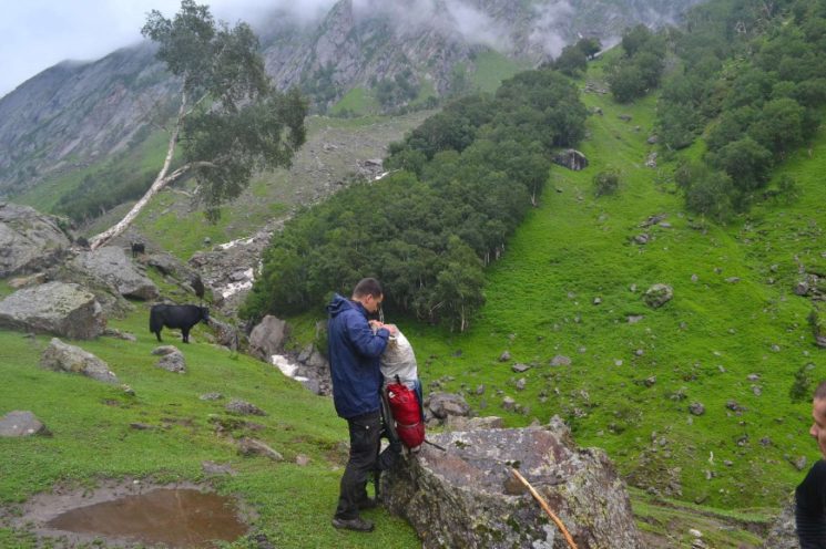
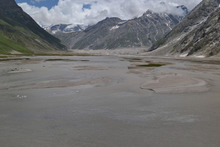
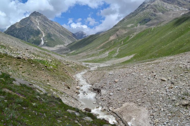
a glacial river from a side valley opening from the right must be straightened.
(Paul’s photo)
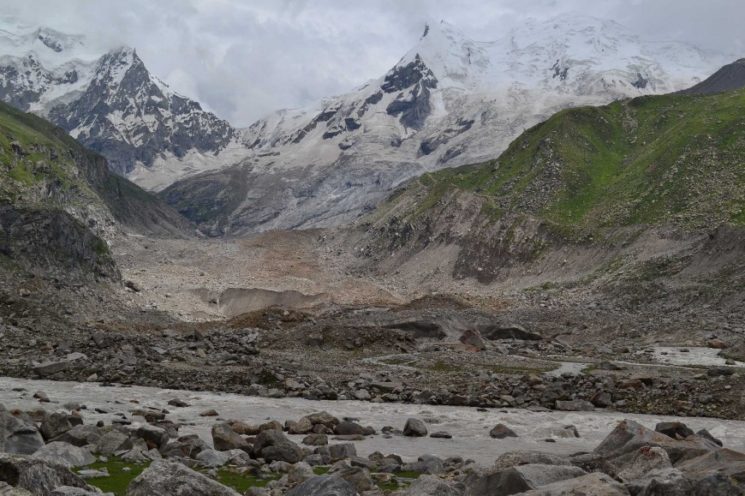
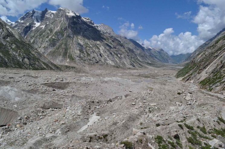
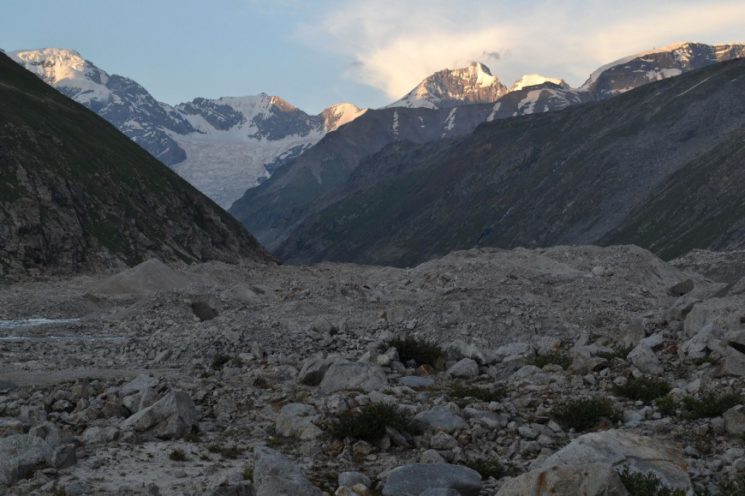
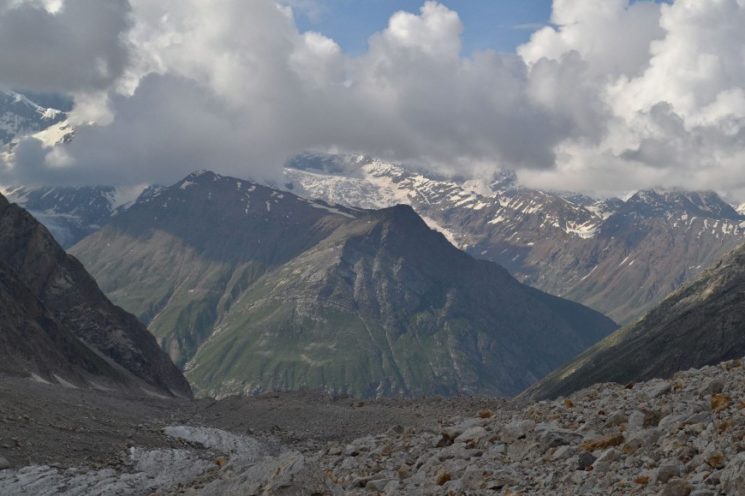
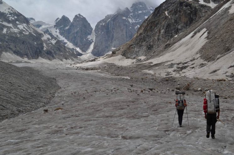
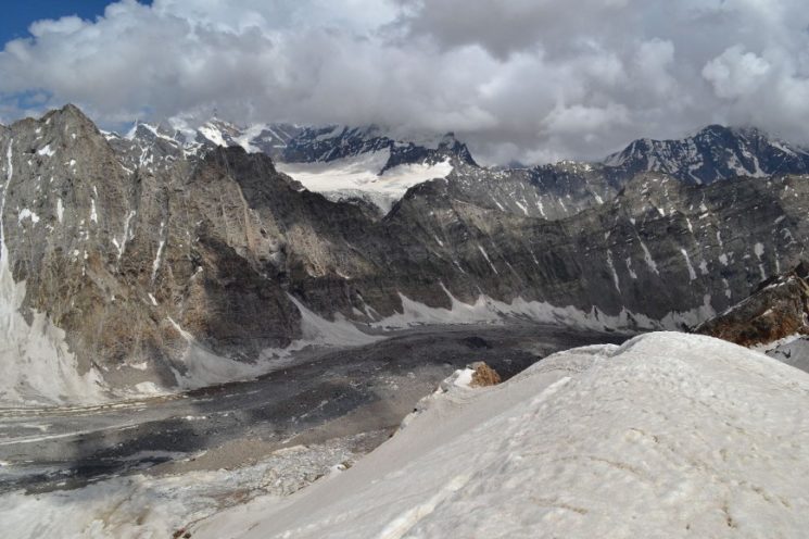
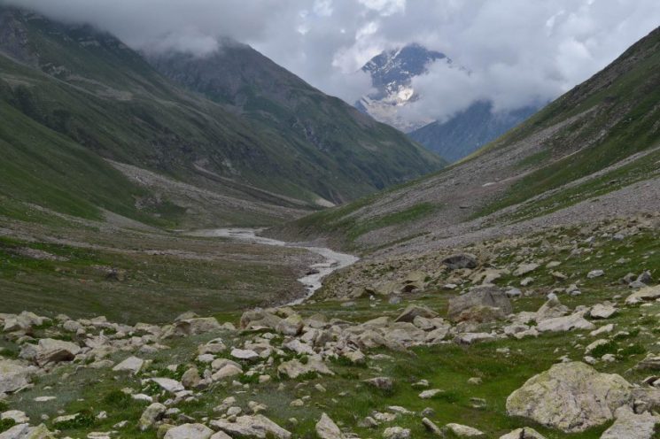
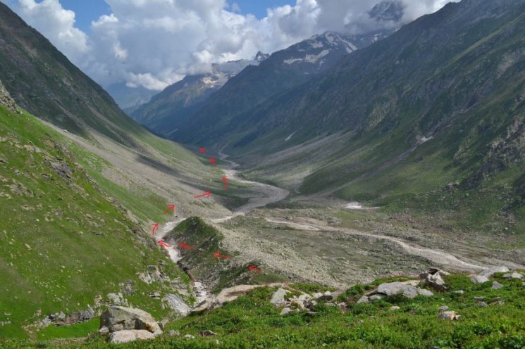
From the next tributary also comes out a glacier that reaches down to the Kiar River. On the moraine terrain we have to cross the glacier tongue for 2 kilometers. It was laborious and slow, the path so indistinct that we are constantly losing it. The rest of today’s route was flat valley hike and easy. Here you look back down the valley.
View into this side valley (Paul’s photo)
behind the glacier crossing it goes flat for 3 kilometers on the next river bank. We see the last humans for the next five days.
In the back you see another morainic glacier that comes from the next tributary valley, which we have to climb tomorrow. Just before the glacier we set up camp.
Camp 6 (3840 m), 73.5 kilometers from the start.
(Paul’s photo)
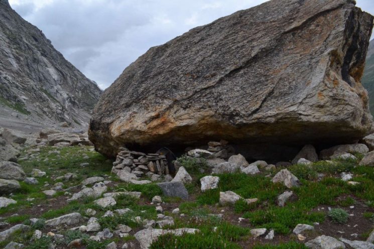
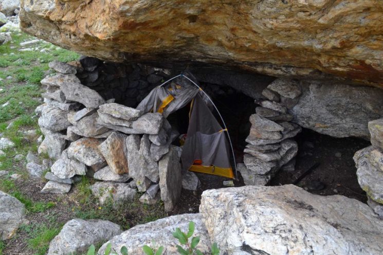
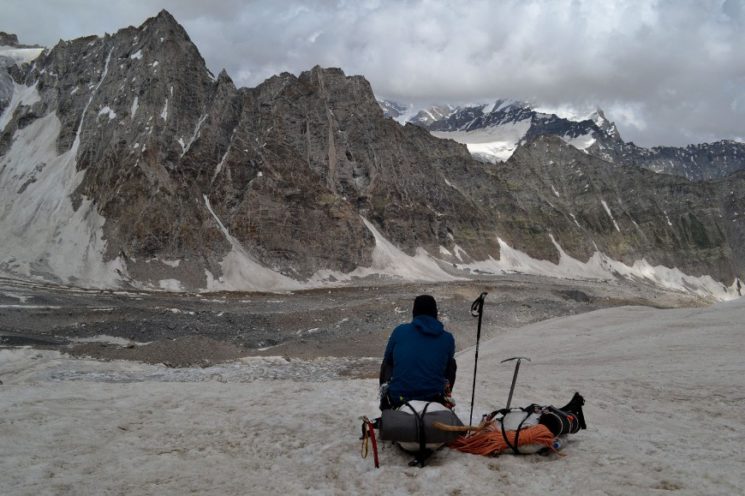
Since it is quite windy when setting up the tent, I open my camp in this protected rock bivouac.
sheltered camp ![]()
in the evening at the camp
Days 7 to 10: Kishtwar National Park
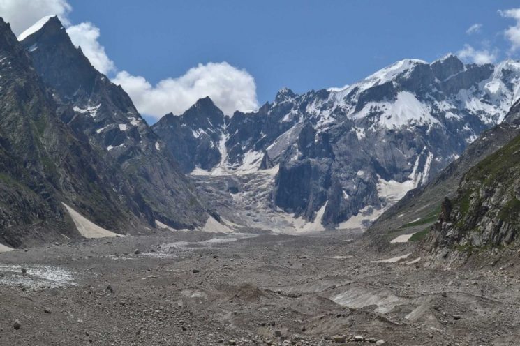
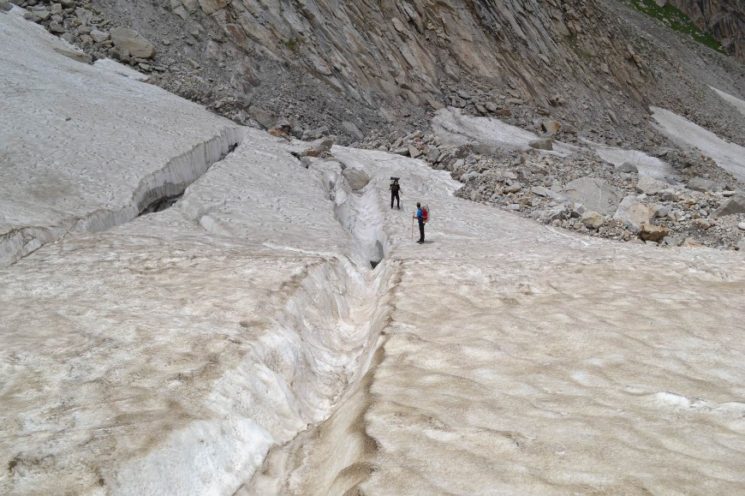
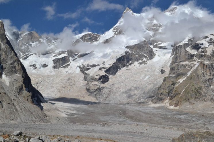
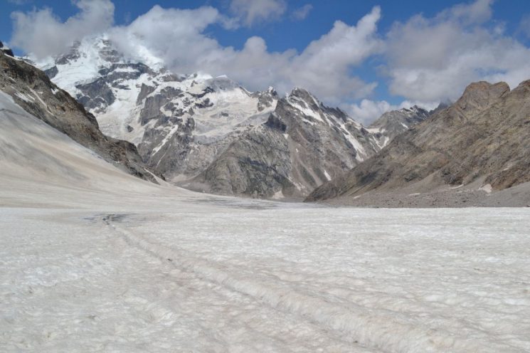
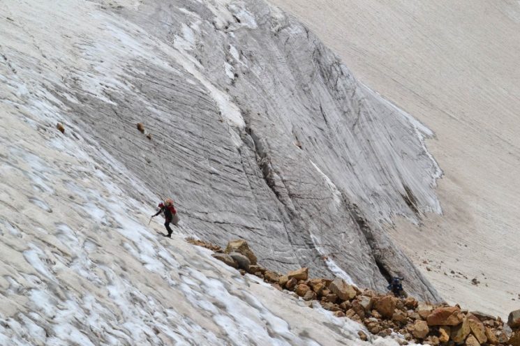
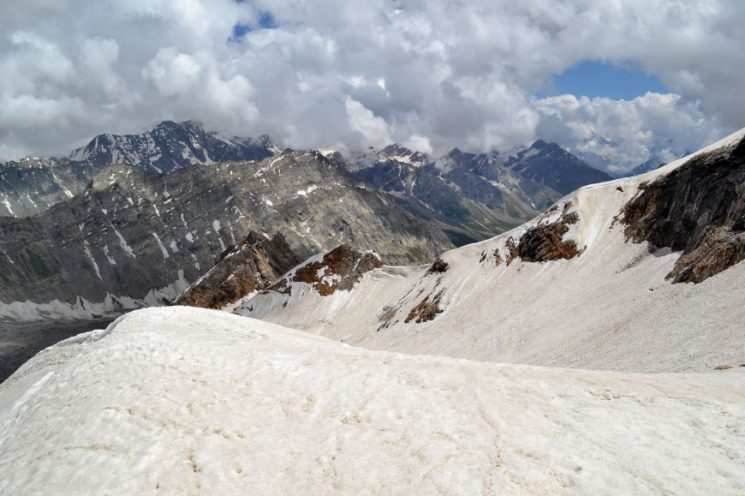
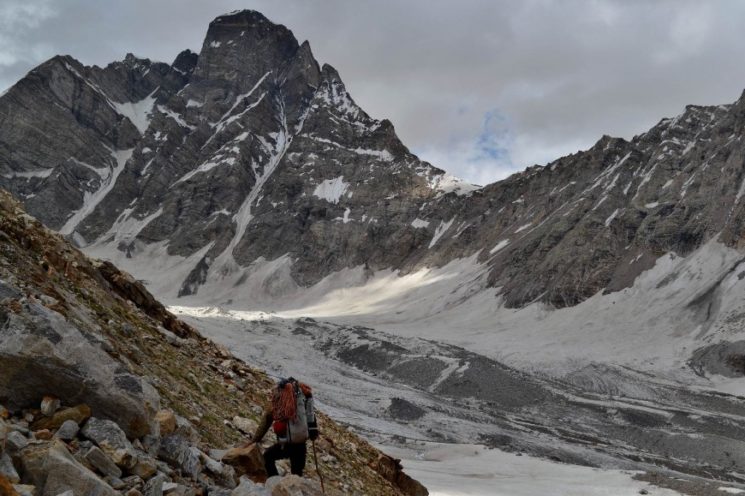
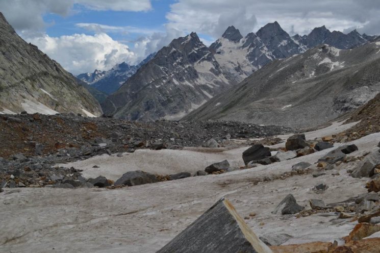
Day 7: Today we hike up the south-facing glacier valley. Shortly after leaving our camp we enter the glacier. For short stretches of today we can hike on ice or hard firn sections, but most of it goes through the nastiest moraine terrain ![]()
![]()
![]() , The progress is slow
, The progress is slow ![]()
![]() but the scenery is awesome
but the scenery is awesome ![]() ,
,
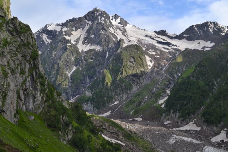
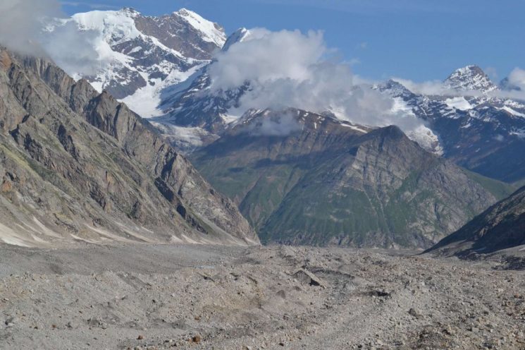
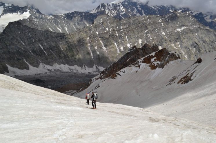
After 10 kilometers, the glacier valley forks into different arms. We have to ascend the left (east) high-leading sidearm. An extremely impassable moraine terrain blocks but the direct access to this side valley ![]() ,
,
We therefore have to go a several kilometer detour.
Directly at the Gletschertalgabelung I suspect a good campsite, which would be our goal for the day.
Since Vincent gets sick, with bad stomach problems and diarrhea, we have to set up an emergency camp two kilometers beforehand on the glacier.
Paul’s and my thin sleeping pads are not made for camping on snow and ice. Therefore, we spend a pretty uncomfortable night on the cold ground ![]()
![]() ,
,
Here are the pictures of the day:
Day 7: bad moraine terrain covers the glacier – view back down the valley
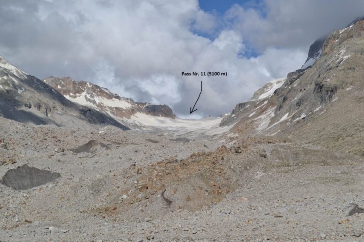
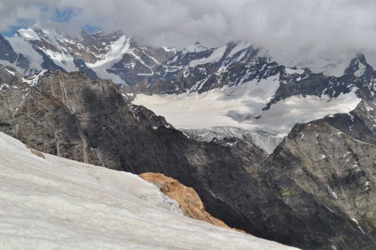
Look into our valley branch with the pass – the lower area looks like a bad moraine terrain and further up it gets easy. As possibly problematic, I suspect the descent on the other side. This looks quite steep according to the contour lines and on Google Earth ![]() ,
,
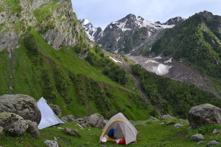
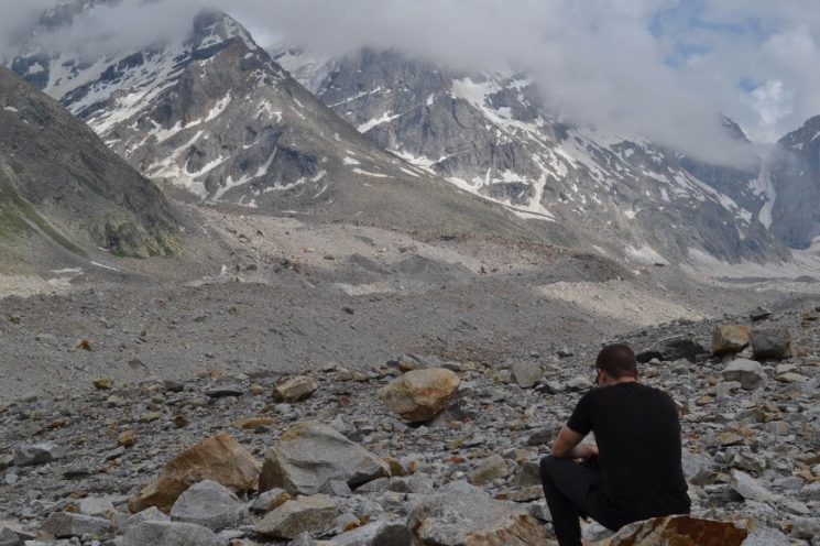
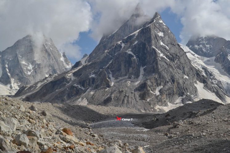
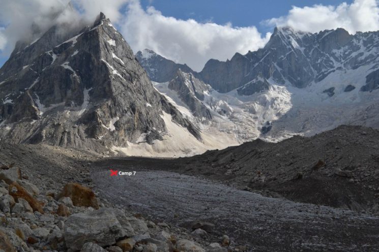
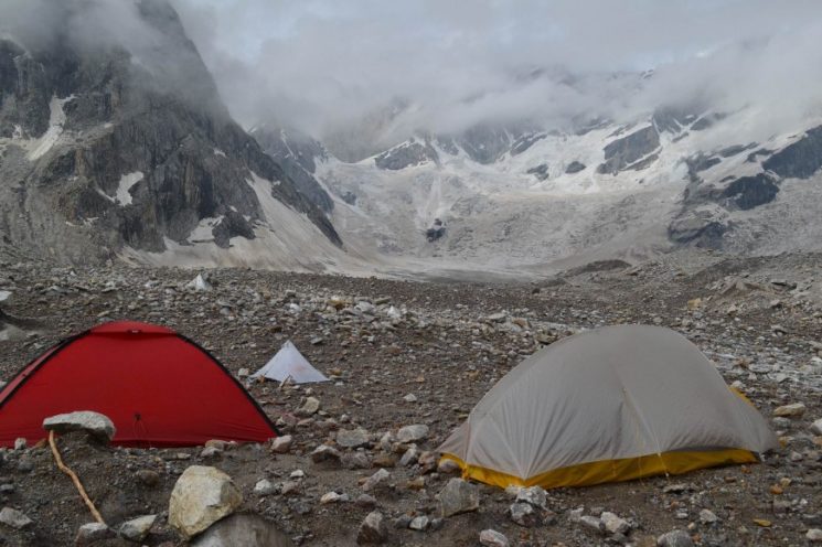
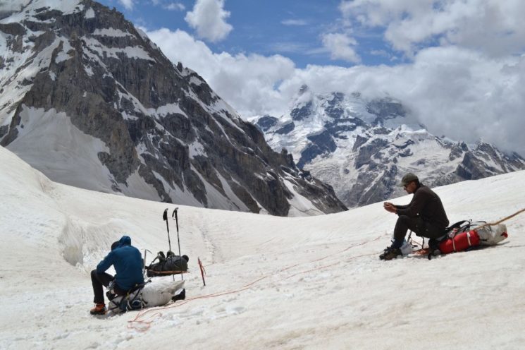
Camp 7 (4400 m) – emergency camp on the ice at the foot of the Sickle Moon Peak.
Day 8: Vincent is still feeling very bad. It is impossible to think about moving on today. But we can not stay here either.
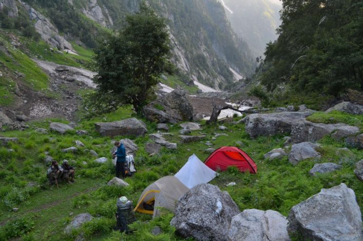
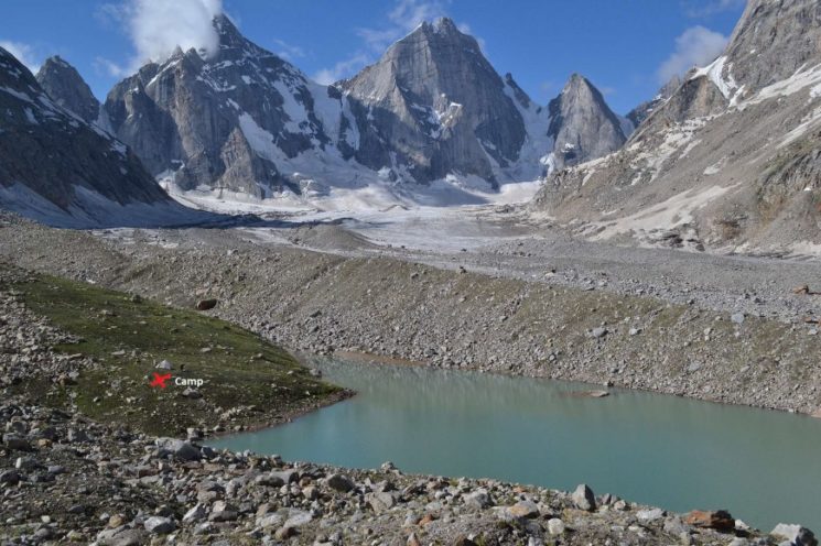
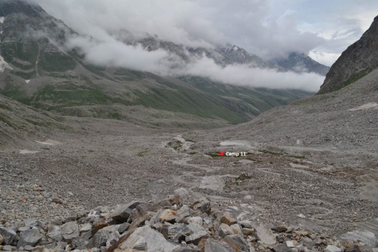
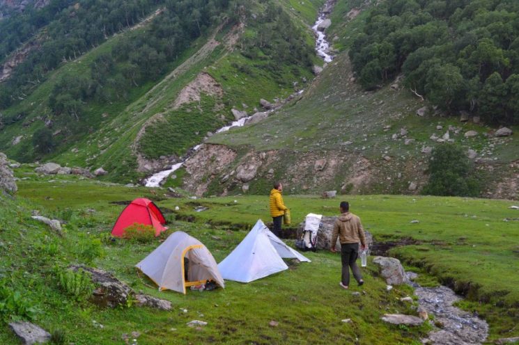
Before breakfast, I go out without luggage the place that we actually wanted to reach yesterday. There I find an ideal campsite on grassy area at a small lake behind the moraine wall, directly at the valley fork. This is not only the best, but probably the only possible camp site between our Camp 6 and Camp 11, if you do not want to camp on ice or snow.
The next three nights we camp there.
It is also discussed what we do if Vincent has to get out. Paul or I would then accompany him back down from the glacier, while the other waits here at the camp. Vincent does not feel like walking back the same way for almost 90 kilometers. If already get out then at least still torment over the pass and get off Machail. Even better, of course, would be wandering all the way to Padum.
On the 10th day, or after three days here at the camp, he is doing well so far that he feels fit enough for the departure. Tomorrow is over the pass.
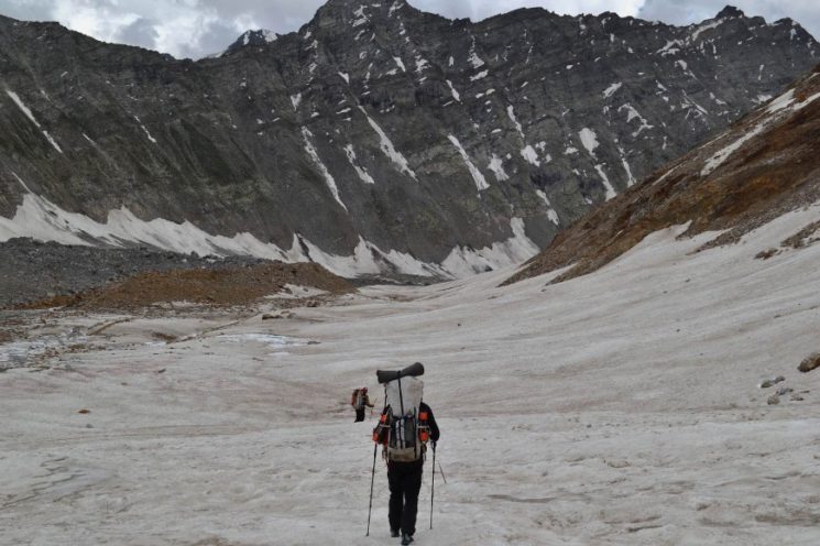
Day 8: on the way to our “dream camp site”.
Relax and cure for three days!
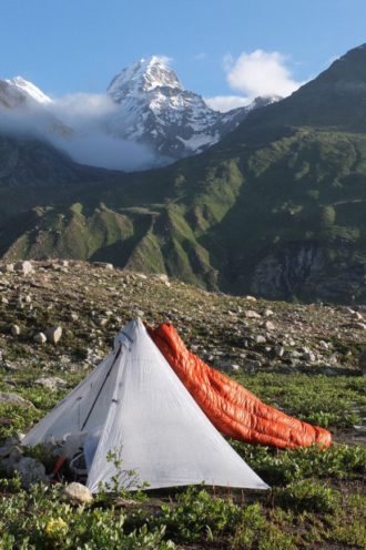
Camp 8, 9 and 10 (4480m), the highest camp so far on the journey, 87 kilometers from the start.
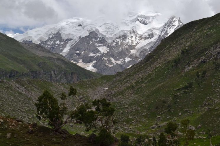
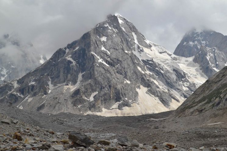
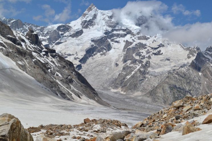
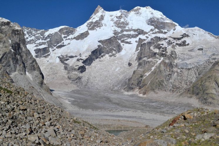
the Sickle Moon Peak from the camp, the highest mountain in Kishtwar National Park
in the background the Sickle Moon Peak (6574 m)
the best campsite far and wide
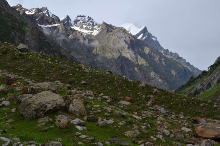
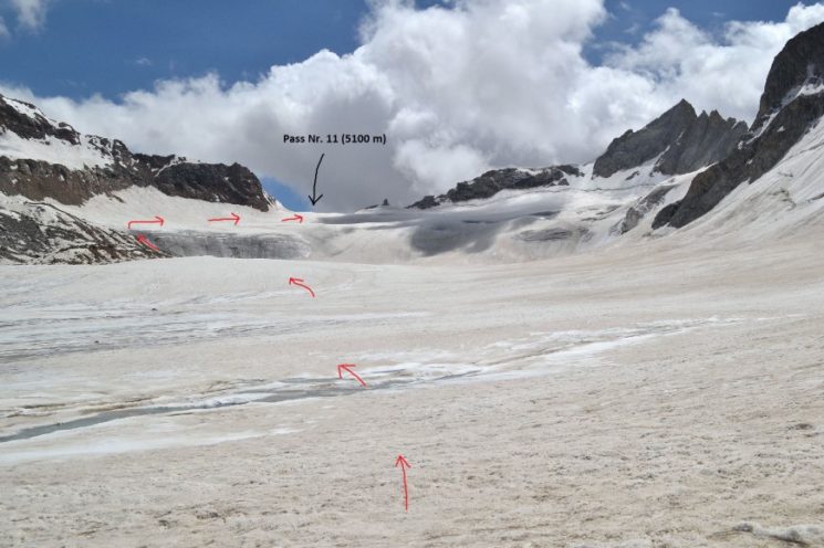
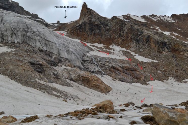
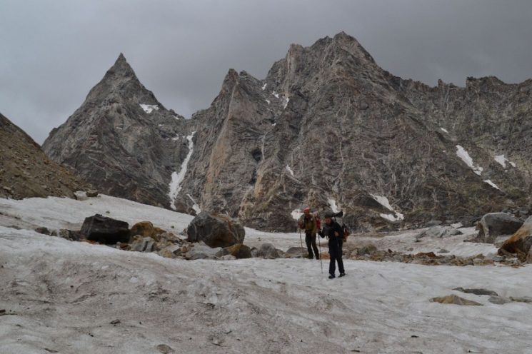
Day 11: the first five-thousand- meter pass
Today we cross our first five-thousand-meter pass. At 7:40 we start. It will be a long 11-hour day.
First, it goes for one and a half kilometers through annoying moraine hills, then over firn and ice up the gentle glacier, with a steep step 150 m below the pass.
Here are the pictures:

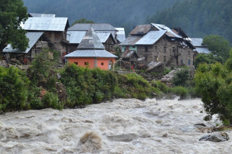
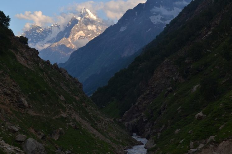
12th and 13th day down the valley to the pilgrim village Machail
It is 26 kilometers to Machail.
I’ve been thinking about which side of the river we should go down the valley.
Finally, we opt for the orographic right side. But I knew that later we have to cross to the left side.

Vincent is walking down the valley from here tomorrow. It is still about 30 kilometers to the start of a runway for him. Paul and I walk up the valley towards Zanskar.
14th and 15th day on the way to Zanskar
Day 14: farewell photo ! Vincent gets out and wanders down the valley. Paul and I travel from Machail the valley branch leading southeast towards Zanskar.
During tour planning at home, I worked out four different routes that lead from Machail via the Himalaya main ridge to Zanskar. So we have a good choice. Each route passes through another pass and all four passes are over 5000m high and glaciated. Finally, we decide on the route via the 5500 m high Muni La, a seemingly unknown pass.
Everyone we tell in Machail that we want to go to Padum assumes that we are going through Umasi La. This is the most famous of the four passes, which is crossed once in a while. No one seems to know the Muni La.
The same later in Padum:
“We came from Machail on foot.”
“Aha, so you’re over the Umasi La!”.
At the mention of Muni La only shrug. Maybe it’s because of my pronunciation ![]() ,
,
I should even show a trekking tour operator from Padum on the map where the Muni La is located ![]() ,
,
Over the Muni La one finds absolutely zero information, … … but according to the Olizane map there is even a path over there, (haha )
From here, Author and his partner moved to the Zanskar Valley.
Authored by : Bernd Looft
Pics Credit : (Bearnd Looft, Paul Turk, & Jan Vincent Klene)
*This travel story is copyrighted to the author and cannot be produced or used without proper permission.