District Kishtwar — The Land of Saffron, Sapphires & Sacred Shrines
A complete guide to one of Jammu & Kashmir’s largest, most scenic, and culturally rich districts
💎 Precious Sapphires
🏔️ Himalayan Wilderness
🕌 Multi-faith Heritage
🌿 Adventure Tourism
Overview & Identity
Kishtwar — where the perfume of saffron drifts across Himalayan ridges, sapphires shimmer beneath ancient riverbeds, and centuries-old shrines stand as timeless sentinels of faith.
Nestled deep in the Greater Himalayas, District Kishtwar is one of Jammu & Kashmir’s most captivating and geographically significant districts. Long celebrated as the Land of Saffron, Sapphires, and Shrines, this storied highland territory has an identity shaped equally by its dramatic natural landscape and its layered, multicultural heritage.
Kishtwar stands apart not just for its extraordinary beauty but for its sheer scale — covering 7,737 sq. km, it ranks as one of the largest districts in the union territory, surpassed in area only by the vast high-altitude districts of Leh and Kargil. Its expanse represents nearly half the combined area of all eleven districts in the Kashmir Valley, and approximately one-third of the entire Jammu region.
World-class Saffron
Kishtwar’s saffron is among the finest grown in India, rivalling Kashmir’s famed variety in colour and aroma.
Sapphire Mines
The Paddar region’s sapphire deposits are internationally renowned, drawing gem traders from across the world.
Sacred Shrines
From the revered Machail Mata temple to ancient ziarats, Kishtwar is a living mosaic of spiritual traditions.
Himalayan Wilderness
Home to the Kishtwar National Park and some of the subcontinent’s most untouched alpine terrain.
Geography & Location
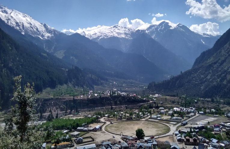
District Kishtwar occupies a rugged, almost entirely mountainous terrain — a landscape reminiscent of Himachal Pradesh’s highland valleys or the stark grandeur of Ladakh. Every corner of the district is defined by towering ranges, thick forests, and pristine river systems.
Coordinates
34°10′ N, 75°25′ E
75–25″ East longitude & 34–10″ North latitude
Plateau Elevation
5,300 ft (1,631 m)
Above mean sea level
Highest Habitation
~9,500 ft
Permanent settlements at high altitude
Total Area
7,737 Sq. Km
From former 11,691 sq. km District Doda
Distance from Jammu
234 km
Via NH 244
Distance from Srinagar
280 km
Approximate road distance
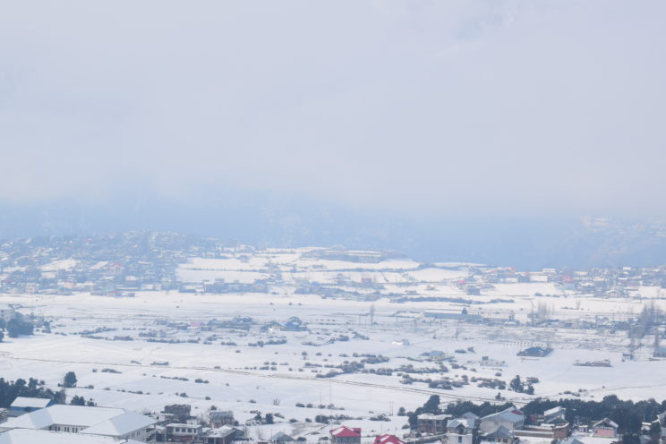
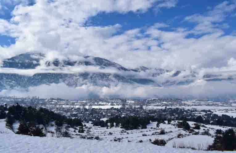
The district shares its southeastern boundary with Himachal Pradesh and its southwestern border with Doda. Nearly the entire district receives substantial snowfall in winter, blanketing high-altitude villages and passes in a pristine white that makes the landscape truly otherworldly. Despite the harsh winters, permanent habitation thrives at altitudes as high as 9,500 feet, a testament to the resilience and adaptability of Kishtwar’s communities.
Historical Background
Kishtwar’s history stretches back through the medieval period when it functioned as an independent hill state, governed by its own rulers and maintaining distinct political autonomy. This changed decisively in 1821 AD, when Maharaja Gulab Singh, the formidable Dogra ruler of Jammu, annexed Kishtwar into his expanding dominion — setting the stage for its eventual integration into the princely state of Jammu & Kashmir.
The modern administrative history of the district took shape in 2007–08, when then Chief Minister G. N. Azad made a landmark decision in July 2006 to carve Kishtwar out from the erstwhile Doda district — a move widely regarded as recognising the region’s distinct geographic identity and the administrative needs of its far-flung population.
The creation of District Kishtwar in 2007–08 was a historic administrative milestone, giving the region its own governance infrastructure and acknowledging its unique identity within Jammu & Kashmir.
Administrative Divisions
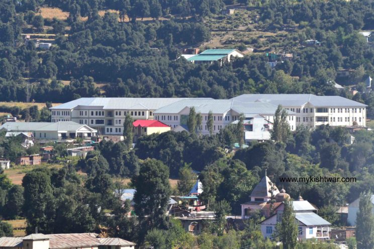
District Kishtwar is divided into 11 tehsils and 13 development blocks, each serving as an administrative hub for the surrounding villages and hamlets. The district headquarters is located in Kishtwar town, the largest urban centre and the cultural heart of the district.
Tehsil-wise Administrative Structure
| # | Tehsil | Households | Total Population | Male | Female |
|---|---|---|---|---|---|
| 1 | Kishtwar | 14,661 | 78,005 | 41,124 | 36,881 |
| 2 | Chhatroo | 3,956 | 18,260 | 9,419 | 8,841 |
| 3 | Mughal Maidan | 5,773 | 25,827 | 13,396 | 12,431 |
| 4 | Marwah | 3,087 | 14,269 | 7,325 | 6,944 |
| 5 | Dachhan | 2,427 | 12,765 | 6,528 | 6,237 |
| 6 | Warwan | 1,592 | 8,538 | 4,511 | 4,027 |
| 7 | Atholi (Paddar) | 3,900 | 19,734 | 10,341 | 9,393 |
| 8 | Machail | 359 | 1,814 | 936 | 878 |
| 9 | Nagseni | 1,874 | 10,670 | 5,512 | 5,158 |
| 10 | Drabshalla | 4,782 | 24,915 | 12,868 | 12,047 |
| 11 | Bonjwah | 2,798 | 15,899 | 8,205 | 7,694 |
| Total | 45,209 | 2,30,696 | 1,20,165 | 1,10,531 | |
Source: Census 2011, Office of the Registrar General & Census Commissioner of India (ORGI)
Demographics & Census Data
According to the Census of India 2011, District Kishtwar recorded a total population of 2,30,696, comprising 1,20,165 males and 1,10,531 females. This marked a decadal growth of +20.88% over the 2001 census figure of 1,90,843 — a healthy rate of growth, slightly below the Jammu & Kashmir state average of +23.71% for the same period.
| Census Year | Area | Total Population | Male | Female |
|---|---|---|---|---|
| 2001 | Rural + Urban | 1,90,843 | 1,00,235 | 90,608 |
| 2011 | Rural | 2,15,831 | 1,11,986 | 1,03,845 |
| 2011 | Urban | 14,865 | 8,179 | 6,686 |
| 2011 | Total | 2,30,696 | 1,20,165 | 1,10,531 |
Source: ORGI Census 2011
Block-wise Population (Census 2011)
| # | Block | Households | Population | Male | Female |
|---|---|---|---|---|---|
| 1 | Drabshalla | 4,782 | 24,915 | 12,868 | 12,047 |
| 2 | Inderwal | 3,956 | 18,260 | 9,419 | 8,841 |
| 3 | Dachhan | 2,427 | 12,765 | 6,528 | 6,237 |
| 4 | Kishtwar | 6,570 | 34,742 | 18,347 | 16,395 |
| 5 | Marwah | 3,087 | 14,269 | 7,325 | 6,944 |
| 6 | Nagseni | 1,874 | 10,670 | 5,512 | 5,158 |
| 7 | Paddar | 4,259 | 21,548 | 11,277 | 10,271 |
| 8 | Warwan | 1,592 | 8,538 | 4,511 | 4,027 |
| 9 | Mughal Maidan | 5,773 | 25,827 | 13,396 | 12,431 |
| 10 | Palmar | 1,568 | 8,241 | 4,150 | 4,091 |
| 11 | Bonjwah | 2,798 | 15,899 | 8,205 | 7,694 |
| 12 | Trigam | 1,357 | 7,355 | 3,840 | 3,515 |
| 13 | Thakrie | 2,456 | 12,802 | 6,608 | 6,194 |
| Rural Total | 42,499 | 2,15,831 | 1,11,986 | 1,03,845 | |
| Urban Total | 2,710 | 14,865 | 8,179 | 6,686 | |
| Grand Total | 45,209 | 2,30,696 | 1,20,165 | 1,10,531 | |
Source: ORGI Census 2011
Religious Composition
One of Kishtwar’s most defining qualities is its harmonious, pluralistic society. Hindus, Muslims, Sikhs, and Buddhists have coexisted here for centuries, sharing festivals, spaces, and daily life in a spirit of mutual respect that distinguishes the district from many others in the region.
| Muslim | Hindu | Sikh | Buddhist | Christian | Jain | Others | Total |
|---|---|---|---|---|---|---|---|
| 1,33,225 | 93,931 | 450 | 2,094 | 277 | 3 | 716 | 2,30,696 |
Source: ORGI Census 2011
Villages & Settlement Pattern
The district encompasses a network of 155 inhabited villages spread across its four principal tehsils, with only a single uninhabited village recorded — a reflection of how thoroughly people have adapted to even the most challenging Himalayan terrain.
| Tehsil | Inhabited Villages | Uninhabited | Total |
|---|---|---|---|
| Kishtwar | 83 | 1 | 84 |
| Paddar | 32 | — | 32 |
| Chhatroo | 13 | — | 13 |
| Marwah | 27 | — | 27 |
| Total | 155 | 1 | 156 |
Source: DSEO Kishtwar
The district also contains one forest block, underlining the significance of its forest cover — a vital ecological resource and a key component of the region’s natural heritage.
Workforce & Economy
The economy of District Kishtwar is primarily agrarian, with cultivation and agricultural labour forming the backbone of rural livelihoods. However, a growing segment of the workforce is engaged in non-agricultural occupations, especially in the Kishtwar tehsil where the largest urban centre is located.
Key findings from the Census 2011 working force data include a significant proportion of marginal workers — particularly women engaged in cultivation — indicating a seasonal and subsistence-heavy economic pattern typical of high-altitude Himalayan districts. The total Scheduled Tribe (ST) population stood at 38,149, comprising 19,889 males and 18,260 females.
| Category | Male | Female | Total |
|---|---|---|---|
| Rural ST Population | 19,840 | 18,229 | 38,069 |
| Urban ST Population | 49 | 31 | 80 |
| Total ST Population | 19,889 | 18,260 | 38,149 |
Source: ORGI Census 2011
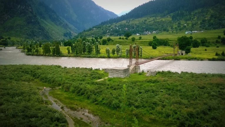
Tourism & Natural Highlights
Beyond its statistical identity, Kishtwar is a destination of extraordinary experiential richness. Whether you seek spiritual solace, alpine adventure, or the simple pleasure of landscapes unmarked by mass tourism, this district delivers in abundance.
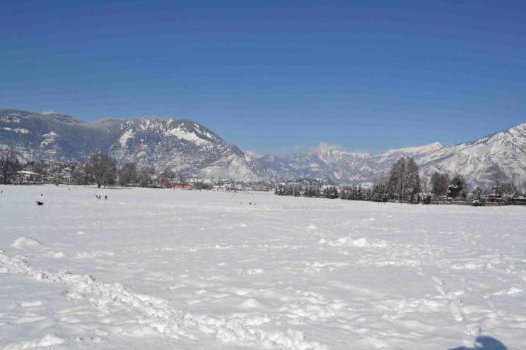
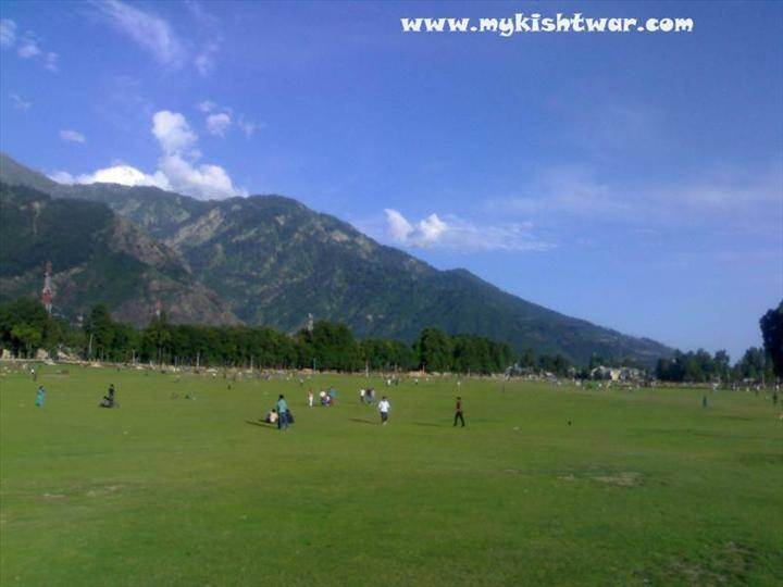
Chowgan Meadow
The iconic green meadow at the heart of Kishtwar town — stunning year-round, magical in snow.
Kishtwar National Park
One of India’s highest altitude wildlife sanctuaries, home to snow leopards and Himalayan brown bears.
Machail Mata Yatra
A revered annual pilgrimage drawing thousands of devotees to the sacred Machail temple each summer.
Hot & Cold Springs
Natural thermal and mineral springs dotted across the district, each with its own local lore and legend.
Adventure Circuits
Trekking, river crossings, and mountaineering across valleys like Warwan, Marwah, and Paddar.
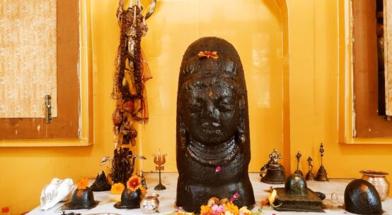
Sarthal Mata Temple
The ancient 18-armed goddess temple — a place of deep spiritual power and architectural heritage.
Kishtwar is not merely a place on a map — it is a way of life, a confluence of landscapes and legacies that has quietly shaped one of the Indian subcontinent’s most extraordinary mountain communities.
Kishtwar
Kishtwar the land of Saffron, Sapphire, and Shrines was an independent hilly state during the medieval period. Maharaja Gulab Singh, the Dogra ruler of Jammu annexed it in 1821 AD.
District Kishtwar was carved out from the erstwhile District Doda during the year 2007-08 when the Chief Minister of state G.N.Azad had taken a historic decision in July 2006 for creation of the new district It has the unique distinction of being one of the biggest districts of the state in the area just next to Leh and Kargil districts. Its area is almost one half of the total area of eleven districts of the valley and one-third of the area of the Jammu region which too has eleven districts.
The population of Kishtwar district is around 2.5lakh. History geography, topography, demography, area, and population define the status of a place or region. Kishtwar is almost mountainous like that of the Himachal or Ladakh region. District Kishtwar has its boundaries touching the valleys of Himachal in the south east and Doda on South-West.
The entire district is full of mountains, forest, and hills. Hindus, Muslims, and Sikhs all reside here with amity and brotherhood. The district has four Tehsils namely Marwah, Paddar, Chhatroo, and Kishtwar with headquarters at Nauphachi, Atholi, Chhatroo, and Kishtwar. An almost entire district receives snowfall during a good winter. Habitation is found even at an altitude of 9,500ft. Kishtwar is full of hidden charm, wonderful sites, and spots, health resorts, tourist locations famous historical and religious places, sacred shrines, and monuments.
The erstwhile District Doda comprised of an area of 11691 Sq. Km. out of which earlier Sub-Division Kishtwar and now District Kishtwar has an area of 7737 Sq.Km. The Plateau of Kishtwar is 5300 feet or 1631 meters above sea level. It lies between 75 -25” East longitude & 34 -10” North latitude. Kishtwar town is 234 kilometers from Jammu & 280 kilometers from Srinagar.
Official Data of Kishtwar
An official Census 2011 detail of Kishtwar, a district of Jammu and Kashmir has been released by Directorate of Census Operations in Jammu and Kashmir. Enumeration of key persons was also done by census officials in Kishtwar District of Jammu and Kashmir.
In 2011, Kishtwar had a population of 230,696 of which males and females were 120,165 and 110,531 respectively. In the 2001 census, Kishtwar had a population of 190,843 of which males were 100,235 and the remaining 90,608 were females.

TOTAL POPULATION OF THE DISTRICT
| Census Year | Rural/Urban | Total Population | Male | Female |
| 1 | 2 | 3 | 4 | 5 |
| 2011 | Total | 230696 | 120165 | 110531 |
| Rural | 215831 | 111986 | 103845 | |
| Urban | 14865 | 8179 | 6686 |
Source: – ORGI- Census 2011
PERCENTAGE DECADAL VARIATION IN POPULATION
| Decade | Jammu & Kashmir State | District Kishtwar |
| 1 | 3 | 4 |
| 2001-2011 | +23.71 | + 20.88 |
Source: – ORGI-Census 2011
POPULATION BY RELIGION (2011 CENSUS)
| District | Muslim | Hindus | Sikh | Buddhists | Christian | Jain | Other Religions group | Religion not stated | Total |
| 1 | 2 | 3 | 4 | 5 | 6 | 7 | 8 | 9 | 10 |
| Kishtwar | 133225 | 93931 | 450 | 2094 | 277 | 3 | 514 | 202 | 230696 |
(Religion wise Population not available) Source: ORGI Census 2011
| S.No. | Name of the Tehsil | Households | Population | Male | Female |
| 1 | Kishtwar | 14661 | 78005 | 41124 | 36881 |
| 2 | Chatroo | 3956 | 18260 | 9419 | 8841 |
| 3 | Mughal Maidan | 5773 | 25827 | 13396 | 12431 |
| 4 | Marwah | 3087 | 14269 | 7325 | 6944 |
| 5 | Dachhan | 2427 | 12765 | 6528 | 6237 |
| 6 | Warwan | 1592 | 8538 | 4511 | 4027 |
| 7 | Atholi | 3900 | 19734 | 10341 | 9393 |
| 8 | Machail | 359 | 1814 | 936 | 878 |
| 9 | Nagseni | 1874 | 10670 | 5512 | 5158 |
| 10 | Drabshalla | 4782 | 24915 | 12868 | 12047 |
| 11 | Bonjwah | 2798 | 15899 | 8205 | 7694 |
| Total | 45209 | 230696 | 120165 | 110531 | |
BLOCK WISE POPULATION AS PER CENSUS 2011
| S.No. | Name of the Block | Households | Population | Male | Female |
| 1 | Drabshalla | 4782 | 24915 | 12868 | 12047 |
| 2 | Inderwal | 3956 | 18260 | 9419 | 8841 |
| 3 | Dachhan | 2427 | 12765 | 6528 | 6237 |
| 4 | Kishtwar | 6570 | 34742 | 18347 | 16395 |
| 5 | Marwah | 3087 | 14269 | 7325 | 6944 |
| 6 | Nagseni | 1874 | 10670 | 5512 | 5158 |
| 7 | Paddar | 4259 | 21548 | 11277 | 10271 |
| 8 | Warwan | 1592 | 8538 | 4511 | 4027 |
| 9 | Mughal Maidan | 5773 | 25827 | 13396 | 12431 |
| 10 | Palmar | 1568 | 8241 | 4150 | 4091 |
| 11 | Bonjwah | 2798 | 15899 | 8205 | 7694 |
| 12 | Trigam | 1357 | 7355 | 3840 | 3515 |
| 13 | Thakrie | 2456 | 12802 | 6608 | 6194 |
| Total population (rural) | 42499 | 215831 | 111986 | 103845 | |
| Total population (urban) | 2710 | 14865 | 8179 | 6686 | |
| Total | 45209 | 230696 | 120165 | 110531 | |
SCHEDULED TRIBE PUPULATION AS PER CENSUS 2011
| Census Year | Rural | Urban | Total | ||||||
| Male | Female | Total | Male | Female | Total | Male | Female | Total | |
| 1 | 2 | 3 | 4 | 5 | 6 | 7 | 8 | 9 | 10 |
| 2011 | 19840 | 18229 | 38069 | 49 | 31 | 80 | 19889 | 18260 | 38149 |
Source: ORGI Census 2011
WORKING FORCE IN DISTRICT KISHTWAR AS PER CENSUS -2011
| S.No | Category of Working Force | Rural | Urban | Total
(Rural + Urban) |
Rural
(F+M) |
Total
(R+U) |
Urban
(F+M) |
|||
| Female | Male | Female | Male | Female | Male | |||||
| 1 | 2 | 3 | 4 | 5 | 6 | 7 | 8 | 9 | 10 | 11 |
| 1 | Main Workers- Agricultural Labourers | 913 | 2653 | 1 | 16 | 914 | 2669 | 3566 | 3583 | 17 |
| 2 | Main Workers- Cultivators | 4512 | 14664 | 6 | 28 | 4518 | 14692 | 19176 | 19210 | 34 |
| 3 | Main Workers-Household Industry | 147 | 246 | 2 | 3 | 149 | 249 | 393 | 398 | 5 |
| 4 | Main Workers –Other Workers | 2375 | 14749 | 652 | 3751 | 3027 | 18500 | 17124 | 21527 | 4403 |
| 5 | Marginal Workers- Agricultural Labourers | 4503 | 8179 | 5 | 26 | 4508 | 8205 | 12682 | 12713 | 31 |
| 6 | Marginal Workers-Cultivators | 11460 | 8571 | 8 | 22 | 11468 | 8593 | 20031 | 20061 | 30 |
| 7 | Marginal Workers-Household Industry | 564 | 206 | 7 | 11 | 571 | 217 | 770 | 788 | 18 |
| 8 | Marginal Workers-Other Workers | 982 | 3372 | 58 | 282 | 1040 | 3654 | 4354 | 4694 | 340 |
| 9 | Non-Workers | 78389 | 59346 | 5947 | 4040 | 84336 | 63386 | 137735 | 147722 | 9987 |
Source: ORGI Census-2011
TEHSIL WISE NUMBER OF INHABITED/UN-INHABITED VILLAGES
| Name of Tehsil | Inhabited | Un-inhabited | Total |
| 1 | 2 | 3 | 4 |
| Kishtwar | 83 | 1 | 84 |
| Paddar | 32 | – | 32 |
| Chatroo | 13 | – | 13 |
| Marwah | 27 | – | 27 |
| Total | 155 | 1 | 156 |
| Number of Forest Block in District Kishtwar | 01 (One) | ||
Source:- DSEO Kishtwar
TEHSILWISE NUMBER OF HOUSEHOLDS IN DISTRICT KISHTWAR
(AS PER CENSUS-2011)
| S.No | Name of Tehsil | Number of House Holds | ||
| Rural | Urban | Total | ||
| 1 | 2 | 3 | 4 | 5 |
| 1 | Atholi (Padder) | 4259 | 0 | 4259 |
| 2 | Chattroo | 9729 | 0 | 9729 |
| 3 | Kishtwar | 21405 | 2710 | 24115 |
| 4 | Marwah | 7106 | 0 | 7106 |
| G.Total | 42499 | 2710 | 45209 | |
Source: – ORGI Census-2011
Follow us on Facebook : mykishtwar.com
Follow us on Instagram : mykishtwar
Follow us on Youtube : mykishtwar.com