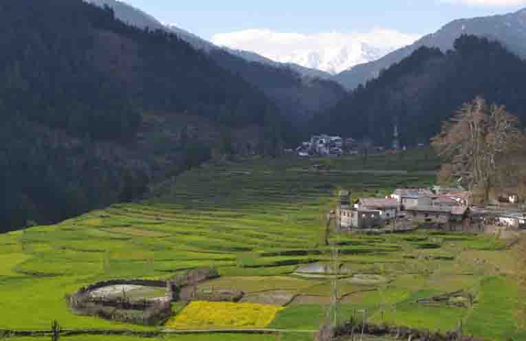
Chattroo is a small village on the bank of a river, Mariv Sudir. The place is located in between the two hills. It is a steep valley which opens from three sides. One way goes to Chingam one goes to Kishtwar and one goes to Passerkoot. This route is very famous right from the beginning. The way was the old and main route for the people of the entire region to enter Kashmir Valley. In the olden times the small mobile traders used to come to the Kishtwar region from Kashmir through this route. This is a hilly track which goes up and down in to purely Himalayan tertian. The people also relied on this route for selling their agriculture products and animals. On this track a famous village named Passerkoot comes, the village is famous for its natural resources like Apple,wallnut, Rajmash and Guchhi.
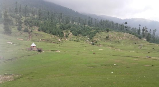
From Chhatroo route one of the famous routes is connected to Kashmir is known as Sintantop route this route also good traveling of transport and now recently Govt. of India and State Govt of J&K start project of Viloo Tunnel (about 5 km long) to reduce the distance of about 60 km from Kashmir to Kishtwar. Presently the distance from LalChowk Kashmir to Kishtwar is only 202 km, so after completion of this tunnel the distance is just near about 140 km. The spot of Sinthantop is very good for tourist and one of the famous spot is AlloForm. One the best spot is Fammer by foot traveling near about 10 km from Sintantop the famous dish is there is trout fish. The enjoy is then that when you visit on that spots.
Chhatroo is the Tehsil headquarter of Chhatroo Tehsil situated on the right bank of Chhatroo Nalla. It is at a distance of 30 kms from Kishtwar and ten kilometers ahead of Mughal Maidan on Kishtwar-Synthan Top-Annant Nag Road. The zig zag road passes along the banks of Chhatroo Nalla with high rising mountains and dense forests on either side of the Nalla. The journey is exhilarating and refreshing.
The present tehsil Chhatroo comprising Chingam, Sing pour, Chhatroo, Drubeel, Kuhhal, Inderwal, Sigdi, Mulchetar, Rahaltal, Horna and Udil Gogran revenue villages was called Rajmandel in ancient Times. It is situated on the South-Easteren extremity of Kashmir and on the North-Western extremity of Kishtwar. Margen Pass also known as Singpur Pass in 3670 meters above sea level. Chhatroo is situated between altitude 33 30 and longtitude75 31. It links Singpur with Gadol in Kashmir valley, another pass linking Chingam with Dakshum village of Kashmir is called Synthan pass which is 3784 meters above sea level. Pogal Paristan in Banihal tehsil of Ramban district is linked through Sambole village of Chhatroo tehsil by Nandmarg pass situated at a height of 4110 meters above sea level. Marwah valley is also linked with Chingam via Bonda but the route is all along very tough and no footpath has emerged for pedestrians. Chhatroo Nalla which rises from Bonda Mountains and joined by other Nalas coming from Khawara and Singpur side divides the valley into two with the population on either side. This stream called Chhatroo River joins Marud Vridha or Mariv Sudir near Dadpeath village which is the gateway to Chhatroo. The whole area from Chhatroo to Singpur top was once covered with dense forests infested ferocious animals. The route to Kashmir valley passed through these forests which was not only hazardous but also unsafe. So there is no easy way to develop relations with the people of Kashmir valley..
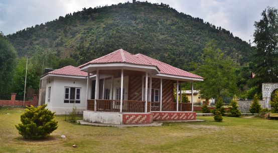
The establishment of a degree college, a Higher Secondary School, Kasturuba School, I.T.I, Girl’s Hostel etc. here in this remote area shows the will of the Government to bring the rural areas at par with the urban one as far as the provision of educational facilities is concerned. Offices of various Govt. Departments and a market add grandeur to this place. Here from the main road goes to Synthen while another road leads to Passerkoot where a 4.5 km long tunnel is proposed to be constructed between Singhpora and Vialu road and an alternative to the National Highway between Batote-Jawahar Tunnel- Anantnag.
List of all Villages in Chhatroo Tehsil of Kishtwar district, Jammu and Kashmir. Complete details of Population, Religion, Literacy and Sex Ratio in tabular format.
Chattroo Population – Kishtwar, Jammu and Kashmir
Chattroo is a large village located in Chhatroo of Kishtwar district, Jammu, and Kashmir with total of 1530 families residing. The Chhatroo village has a population of 6944 of which 3602 are males while 3342 are females as per Population Census 2011.
In Chhatroo village the population of children age 0-6 is 1390 which makes up 20.02 % of the total population of the village. The average Sex Ratio of Chhatroo village is 928 which is higher than the Jammu and Kashmir state average of 889. The child Sex Ratio for the Chhatroo as per census is 952, higher than Jammu and Kashmir average of 862.
Chhatroo village has a lower literacy rate compared to Jammu and Kashmir. In 2011, the literacy rate of Chhatroo village was 48.34 % compared to 67.16 % of Jammu and Kashmir. In Chhatroo Male literacy stands at 60.45 % while the female literacy rate was 35.21 %.
As per the constitution of India and the Panchyati Raaj Act, Chhatroo village is administrated by the Sarpanch (Head of Village) who is elected representative of the village.
Chhatroo Data
| Particulars |
Total |
Male |
Female |
| Total No. of Houses |
1,530 |
– |
– |
| Population |
6,944 |
3,602 |
3,342 |
| Child (0-6) |
1,390 |
712 |
678 |
| Scheduled Caste |
444 |
233 |
211 |
| Scheduled Tribe |
2,581 |
1,345 |
1,236 |
| Literacy |
48.34 % |
60.45 % |
35.21 % |
| Total Workers |
2,671 |
1,718 |
953 |
| Main Worker |
715 |
0 |
0 |
| Marginal Worker |
1,956 |
1,117 |
839 |
Caste Factor
In Chhatroo village, most of the village population is from Schedule Tribe (ST). Scheduled Tribe (ST) constitutes 37.17 % while Schedule Caste (SC) was 6.39 % of the total population in Chhatroo village.
Work Profile
In Chhatroo village out of the total population, 2671 were engaged in work activities. 26.77 % of workers describe their work as Main Work (Employment or Earning more than 6 Months) while 73.23 % were involved in Marginal activity providing a livelihood for less than 6 months. Of 2671 workers engaged in Main Work, 58 were cultivators (owner or co-owner) while 49 were Agricultural laborer.
Chingam Population – Kishtwar, Jammu and Kashmir
Chingam is a large village located in Chhatroo of Kishtwar district, Jammu, and Kashmir with total of 969 families residing. The Chingam village has a population of 4717 of which 2419 are males while 2298 are females as per Population Census 2011.
In Chingam village population of children age 0-6 is 848 which makes up 17.98 % of the total population of the village. The average Sex Ratio of Chingam village is 950 which is higher than the Jammu and Kashmir state average of 889. The child Sex Ratio for the Chingam as per census is 1084, higher than Jammu and Kashmir average of 862.
Chingam village has a lower literacy rate compared to Jammu and Kashmir. In 2011, the literacy rate of Chingam village was 39.00 % compared to 67.16 % of Jammu and Kashmir. In Chingam Male literacy stands at 49.65 % while female literacy rate was 27.46 %.
As per the constitution of India and the Panchyati Raj Act, Chingam village is administrated by Sarpanch (Head of Village) who is elected representative of the village.
Chingam Data
| Particulars |
Total |
Male |
Female |
| Total No. of Houses |
969 |
– |
– |
| Population |
4,717 |
2,419 |
2,298 |
| Child (0-6) |
848 |
407 |
441 |
| Schedule Caste |
196 |
103 |
93 |
| Schedule Tribe |
1,074 |
581 |
493 |
| Literacy |
39.00 % |
49.65 % |
27.46 % |
| Total Workers |
1,755 |
1,215 |
540 |
| Main Worker |
434 |
0 |
0 |
| Marginal Worker |
1,321 |
814 |
507 |
Caste Factor
Schedule Tribe (ST) constitutes 22.77 % while Schedule Caste (SC) was 4.16 % of the total population in Chingam village.
Work Profile
In Chingam village out of the total population, 1755 were engaged in work activities. 24.73 % of workers describe their work as Main Work (Employment or Earning more than 6 Months) while 75.27 % were involved in Marginal activity providing a livelihood for less than 6 months. Of 1755 workers engaged in Main Work, 11 were cultivators (owner or co-owner) while 62 were Agricultural laborer.
Dichar Population – Kishtwar, Jammu and Kashmir
Dichar is a medium size village located in Chhatroo of Kishtwar district, Jammu and Kashmir with total 75 families residing. The Dichar village has population of 329 of which 162 are males while 167 are females as per Population Census 2011.
In Dichar village the population of children with age 0-6 is 101 which makes up 30.70 % of total population of village. Average Sex Ratio of Dichar village is 1031 which is higher than Jammu and Kashmir state average of 889. Child Sex Ratio for the Dichar as per census is 1405, higher than Jammu and Kashmir average of 862.
Dichar village has lower literacy rate compared to Jammu and Kashmir. In 2011, literacy rate of Dichar village was 42.98 % compared to 67.16 % of Jammu and Kashmir. In Dichar Male literacy stands at 49.17 % while female literacy rate was 36.11 %.
As per constitution of India and Panchyati Raaj Act, Dichar village is administrated by Sarpanch (Head of Village) who is elected representative of village.
Dichar Data
| Particulars |
Total |
Male |
Female |
| Total No. of Houses |
75 |
– |
– |
| Population |
329 |
162 |
167 |
| Child (0-6) |
101 |
42 |
59 |
| Schedule Caste |
0 |
0 |
0 |
| Schedule Tribe |
276 |
137 |
139 |
| Literacy |
42.98 % |
49.17 % |
36.11 % |
| Total Workers |
167 |
90 |
77 |
| Main Worker |
7 |
0 |
0 |
| Marginal Worker |
160 |
84 |
76 |
Caste Factor
In Dichar village, most of the village population is from Schedule Tribe (ST). Schedule Tribe (ST) constitutes 83.89 % of total population in Dichar village. There is no population of Schedule Caste (SC) in Dichar village of Kishtwar.
Work Profile
In Dichar village out of total population, 167 were engaged in work activities. 4.19 % of workers describe their work as Main Work (Employment or Earning more than 6 Months) while 95.81 % were involved in Marginal activity providing livelihood for less than 6 months. Of 167 workers engaged in Main Work, 0 were cultivators (owner or co-owner) while 0 were Agricultural labourer.
Udil Gojran Population – Kishtwar, Jammu and Kashmir
Udil Gojran is a medium size village located in Chhatroo of Kishtwar district, Jammu and Kashmir with total 160 families residing. The Udil Gojran village has population of 758 of which 382 are males while 376 are females as per Population Census 2011.
In Udil Gojran village population of children with age 0-6 is 161 which makes up 21.24 % of total population of village. Average Sex Ratio of Udil Gojran village is 984 which is higher than Jammu and Kashmir state average of 889. Child Sex Ratio for the Udil Gojran as per census is 1038, higher than Jammu and Kashmir average of 862.
Udil Gojran village has lower literacy rate compared to Jammu and Kashmir. In 2011, literacy rate of Udil Gojran village was 40.87 % compared to 67.16 % of Jammu and Kashmir. In Udil Gojran Male literacy stands at 55.78 % while female literacy rate was 25.51 %.
As per constitution of India and Panchyati Raaj Act, Udil Gojran village is administrated by Sarpanch (Head of Village) who is elected representative of village.
Udil Gojran Data
| Particulars |
Total |
Male |
Female |
| Total No. of Houses |
160 |
– |
– |
| Population |
758 |
382 |
376 |
| Child (0-6) |
161 |
79 |
82 |
| Schedule Caste |
0 |
0 |
0 |
| Schedule Tribe |
711 |
357 |
354 |
| Literacy |
40.87 % |
55.78 % |
25.51 % |
| Total Workers |
191 |
180 |
11 |
| Main Worker |
53 |
0 |
0 |
| Marginal Worker |
138 |
132 |
6 |
Caste Factor
In Udil Gojran village, most of the village population is from Schedule Tribe (ST). Schedule Tribe (ST) constitutes 93.80 % of total population in Udil Gojran village. There is no population of Schedule Caste (SC) in Udil Gojran village of Kishtwar.
Work Profile
In Udil Gojran village out of total population, 191 were engaged in work activities. 27.75 % of workers describe their work as Main Work (Employment or Earning more than 6 Months) while 72.25 % were involved in Marginal activity providing livelihood for less than 6 months. Of 191 workers engaged in Main Work, 1 were cultivators (owner or co-owner) while 1 were Agricultural labourer.
Indarwal Population – Kishtwar, Jammu and Kashmir
Indarwal is a large village located in Chhatroo of Kishtwar district, Jammu and Kashmir with total 1222 families residing. The Indarwal village has population of 5512 of which 2854 are males while 2658 are females as per Population Census 2011.
In Indarwal village population of children with age 0-6 is 1072 which makes up 19.45 % of total population of village. Average Sex Ratio of Indarwal village is 931 which is higher than Jammu and Kashmir state average of 889. Child Sex Ratio for the Indarwal as per census is 1019, higher than Jammu and Kashmir average of 862.
Indarwal village has lower literacy rate compared to Jammu and Kashmir. In 2011, literacy rate of Indarwal village was 46.33 % compared to 67.16 % of Jammu and Kashmir. In Indarwal Male literacy stands at 58.63 % while female literacy rate was 32.83 %.
As per constitution of India and Panchyati Raaj Act, Indarwal village is administrated by Sarpanch (Head of Village) who is elected representative of village.
Indarwal Data
| Particulars |
Total |
Male |
Female |
| Total No. of Houses |
1,222 |
– |
– |
| Population |
5,512 |
2,854 |
2,658 |
| Child (0-6) |
1,072 |
531 |
541 |
| Schedule Caste |
416 |
208 |
208 |
| Schedule Tribe |
1,424 |
760 |
664 |
| Literacy |
46.33 % |
58.63 % |
32.83 % |
| Total Workers |
2,231 |
1,413 |
818 |
| Main Worker |
585 |
0 |
0 |
| Marginal Worker |
1,646 |
894 |
752 |
Caste Factor
Indarwal village of Kishtwar has substantial population of Schedule Tribe (ST). Schedule Tribe (ST) constitutes 25.83 % while Schedule Caste (SC) were 7.55 % of total population in Indarwal village.
Work Profile
In Indarwal village out of total population, 2231 were engaged in work activities. 26.22 % of workers describe their work as Main Work (Employment or Earning more than 6 Months) while 73.78 % were involved in Marginal activity providing livelihood for less than 6 months. Of 2231 workers engaged in Main Work, 203 were cultivators (owner or co-owner) while 59 were Agricultural labourer.